
One map-based platform for every department in your municipality.
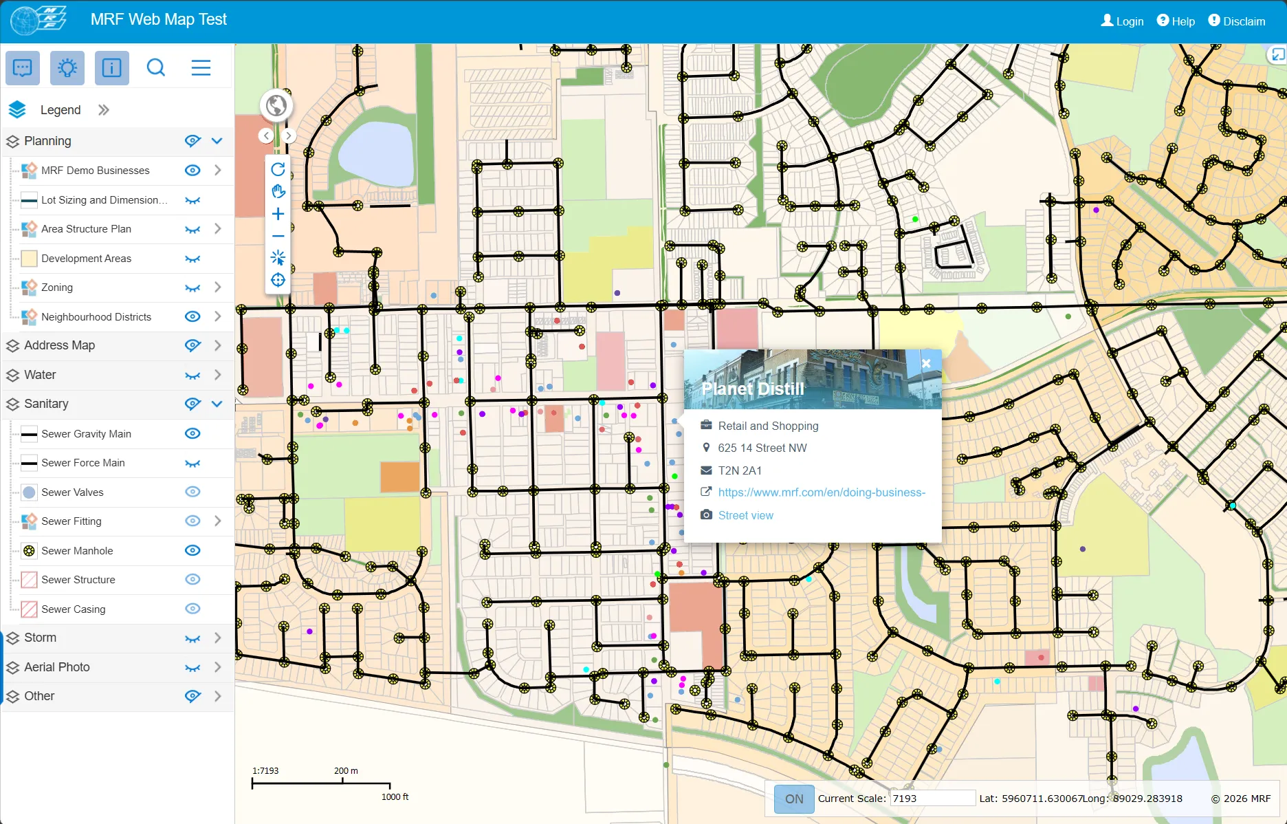
Local governments run on location: every permit, pothole, culvert, grave plot and tax roll is tied to a place. The MRF Municipal Solution puts that place at the centre. MRF Web Map gives every department a shared, browser-based map of your municipality’s data, and purpose-built modules handle the workflows each department owns.
One platform, many modules
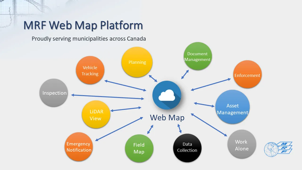
Each module brings additional capabilities into the same map environment, from asset inventories, work orders and vehicle tracking to street-level imagery, document management, inspections and more. Your data stays connected in one centralized repository instead of scattered across disconnected systems, so staff can view, manage, analyze and make informed decisions from one place.
Find what your department needs
Taxation and corporate services
Start with Property & Taxation, for assessment and tax information on every parcel.
Planning & Development
See the Planning & Development module and our latest Public Submission Portal, which lets applicants apply online. MRF StreetView may interest you as well.
Public Works & Infrastructure
See Public Works & Infrastructure for drawings, work orders, fleet, field data and assets, and our latest AI Road Condition Assessment.
Administration
See MRF Timesheet, MRF Safety Lite for staff working alone, and the AI-powered MRF DocRetrieve.
Fleet and vehicle tracking
Everything for tracking is on the MRF Vehicle Tracking Solution page.
Agricultural services
Agricultural staff have all of their solutions on a dedicated page: the MRF Agricultural Solution.
Services
Need help beyond the software? MRF also offers services, from custom development and integration to consulting, field data collection and a GIS help desk.
Why choose the Municipal solution
One source of truth
Parcels, roads, assets, permits and documents live in one spatial database instead of a dozen disconnected systems.
Add modules as you grow
Start with the web map and switch on Asset Management, Work Orders, Vehicle Tracking and more when you need them.
Office and field, in sync
Mobile and Windows apps work offline and sync back to the web map when a connection returns.
Built with municipalities
Trusted by 60+ municipalities across British Columbia, Alberta and Saskatchewan, and shaped by their day-to-day workflows.
Products in the Municipal solution
Use them on their own or together. They share the same map, users and data.

MRF Web Map
Publish your municipality's GIS data online in hours, not days. Search, identify, edit, mark up and print from any browser, then add modules for the workflows each department owns.
Learn more →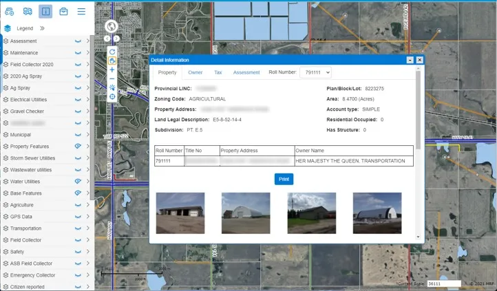
Property & Taxation
Connect MRF Web Map to your taxation database and give staff the latest land, ownership, assessment and tax information for any parcel in one click.
Learn more →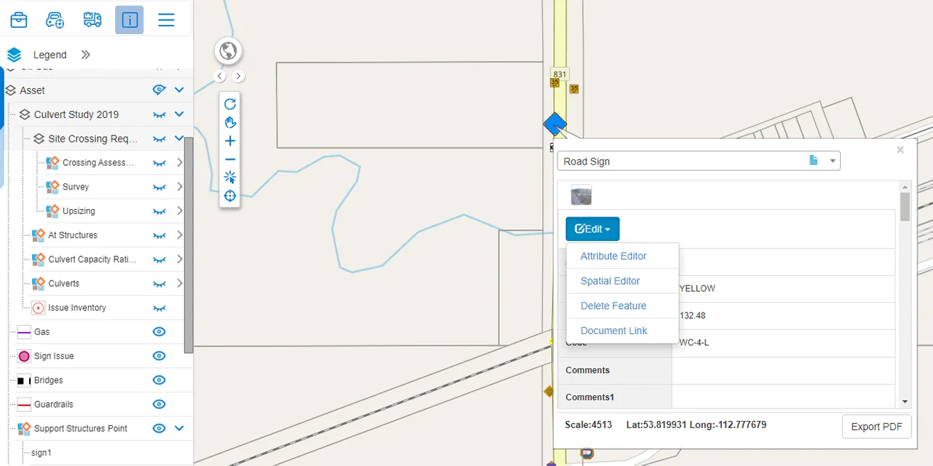
Asset Management
A map-based asset register with inspections, work orders, depreciation curves and documents, filtered any way you need: by type, install year, condition, assessment date or a shape drawn on the map.
Learn more →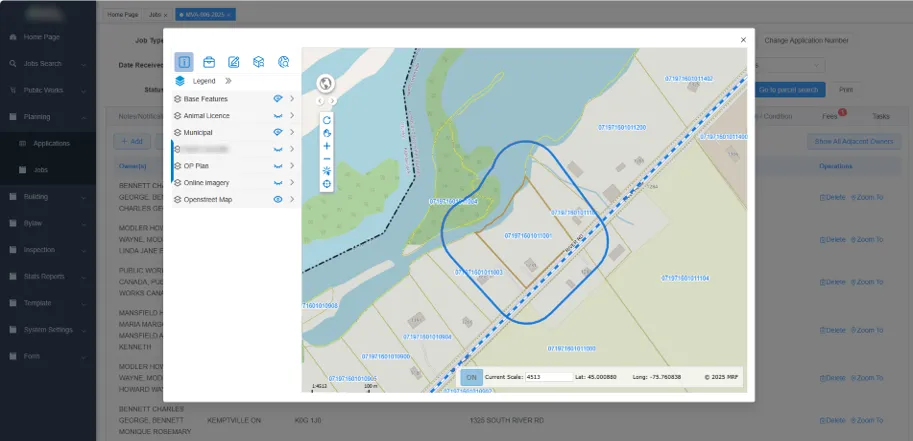
Planning & Development
Manage development permits and planning applications with every parcel, landowner and referral in context. Deploy it as an add-on to MRF Web Map, or as a dedicated planning portal for your whole planning and building team.
Learn more →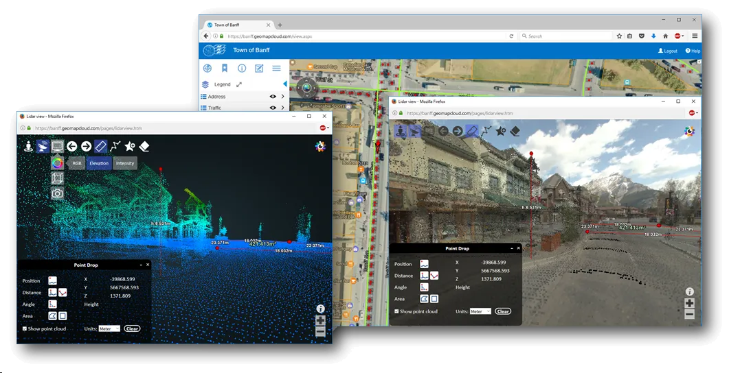
MRF StreetView
Like Google Street View, but for your municipality, on your schedule, and with LiDAR point clouds behind each scene. Browse 360° imagery collected along your roads, measure anything you can see, and extract signs and other features right from the imagery.
Learn more →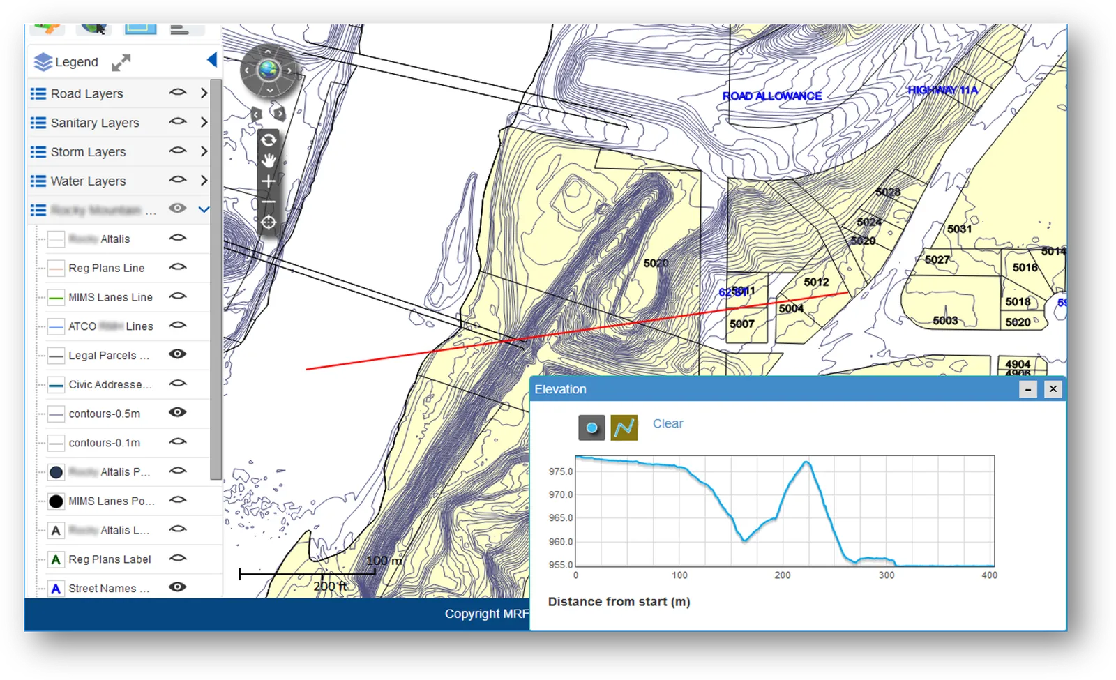
Public Works & Infrastructure
MRF brings together the modules public works crews use every day, built on a municipal utility data model and MRF Web Map, with tools for elevation profiles and road allowance records beyond the traditional utility layers.
Learn more →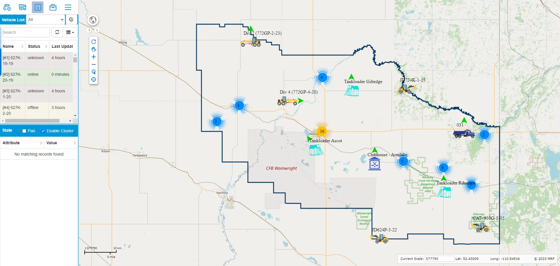
MRF Vehicle Tracking Module
A tracking module for MRF Web Map. Everyday users see every grader, plow and truck live alongside your roads, addresses and assets, replay where vehicles have been, and prove service coverage with spatial reports.
Learn more →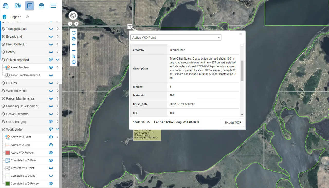
Work Orders
Generate work orders from any location or asset on the map, assign and review them from one panel, and let staff or residents submit requests with photos from a companion app.
Learn more →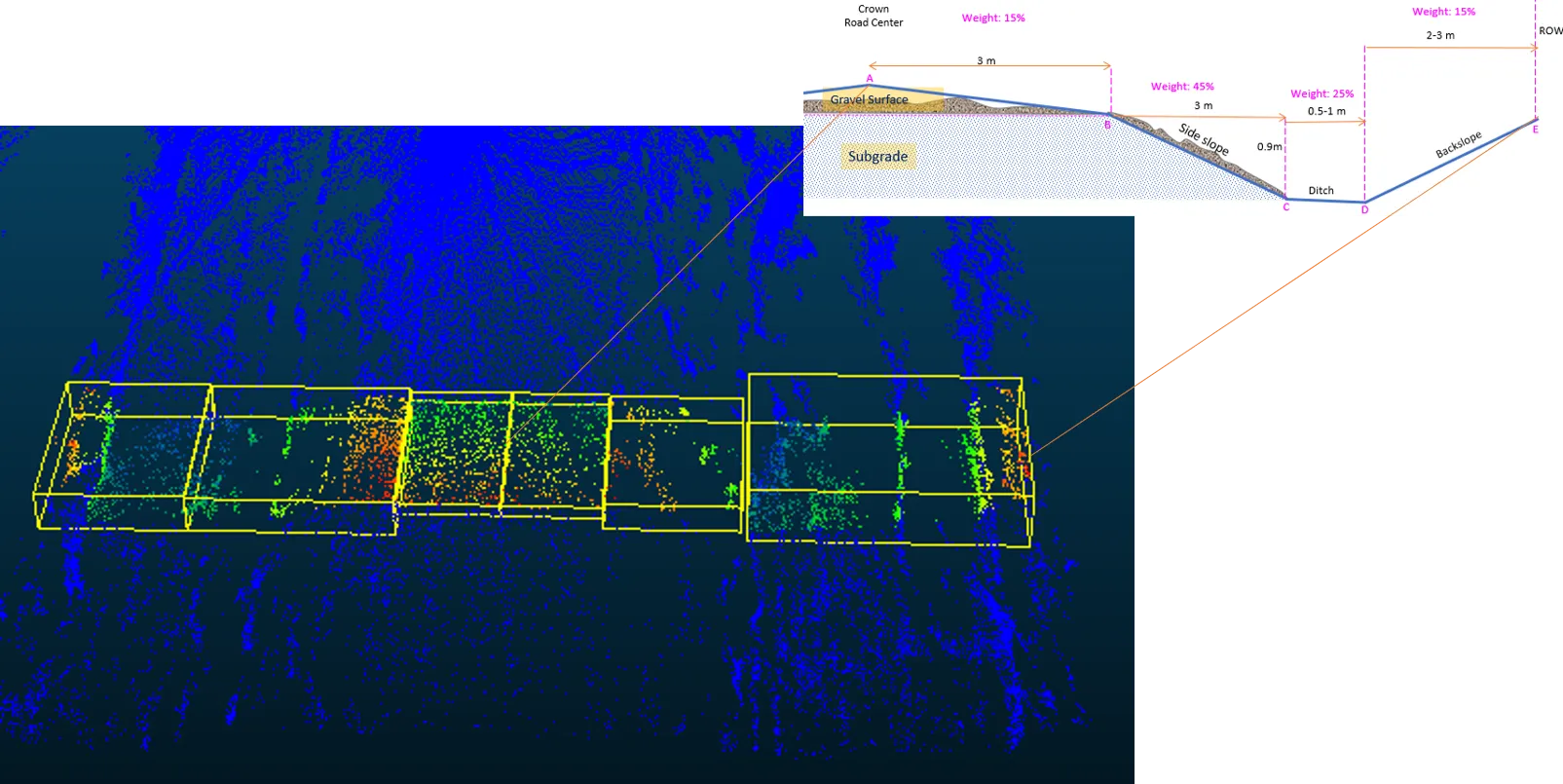
LiDAR Road Condition Assessment
A solid-state LiDAR scanner mounted on a truck measures the full cross-section of your gravel roads, from crown to backslope, and scores every section consistently. Measurement replaces rulers, gauges and guesswork.
Learn more →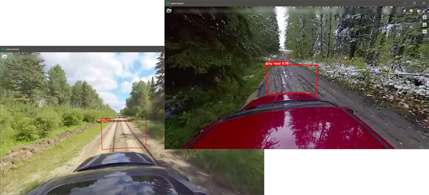
AI Road Condition Assessment
Run deep learning-based Gravel Road Assessment Models on your dashcam video. They detect and locate issues such as rutting and dirty or muddy road, and assign a road condition class, so you can rate your gravel road network without a windshield survey.
Learn more →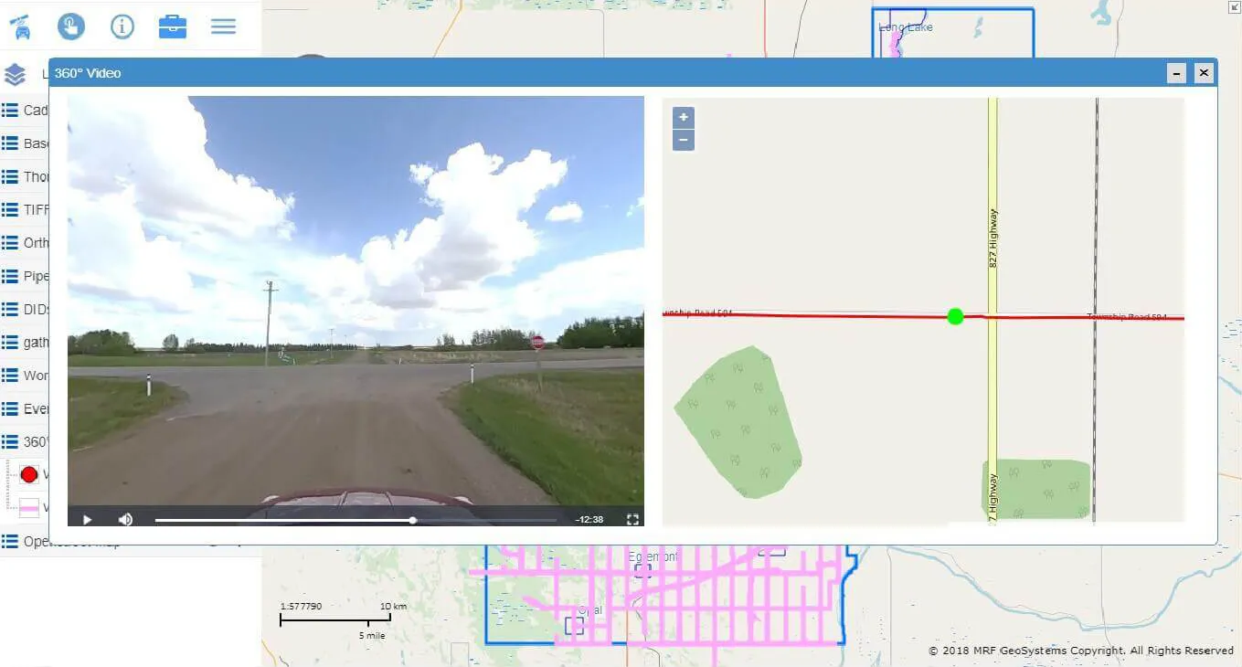
360 Road Video
A cost-effective panoramic video record of every road you own: a visual baseline for asset inventories, planning, and before-and-after evidence for disaster recovery funding.
Learn more →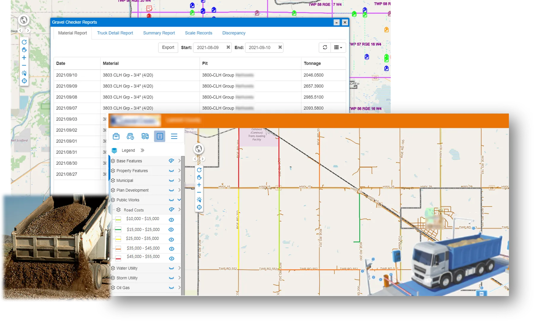
Gravel Checker App
A Windows app that works together with your MRF Web Map configuration. It can integrate with your gravel scale system and automatically calculate the gravel each truck carried and dumped on the road, so by the end of the day managers know how much tonnage went on which road segments.
Learn more →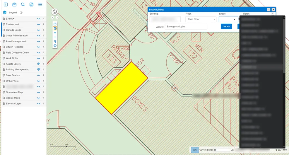
Building Extension
Bring building floor plans into MRF Web Map. Pick a building, floor and room to find it on the plan, and see the assets inside, from emergency lights to equipment, alongside MRF Asset Management.
Learn more →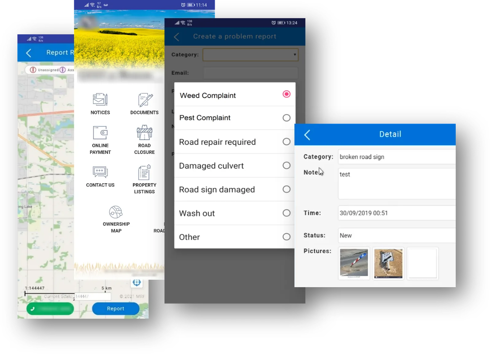
Citizen Report App
Residents pick a problem from your list, take a photo, add their contact information and send it with its GPS location. Your rules turn each report into a work order or ticket and assign it automatically.
Learn more →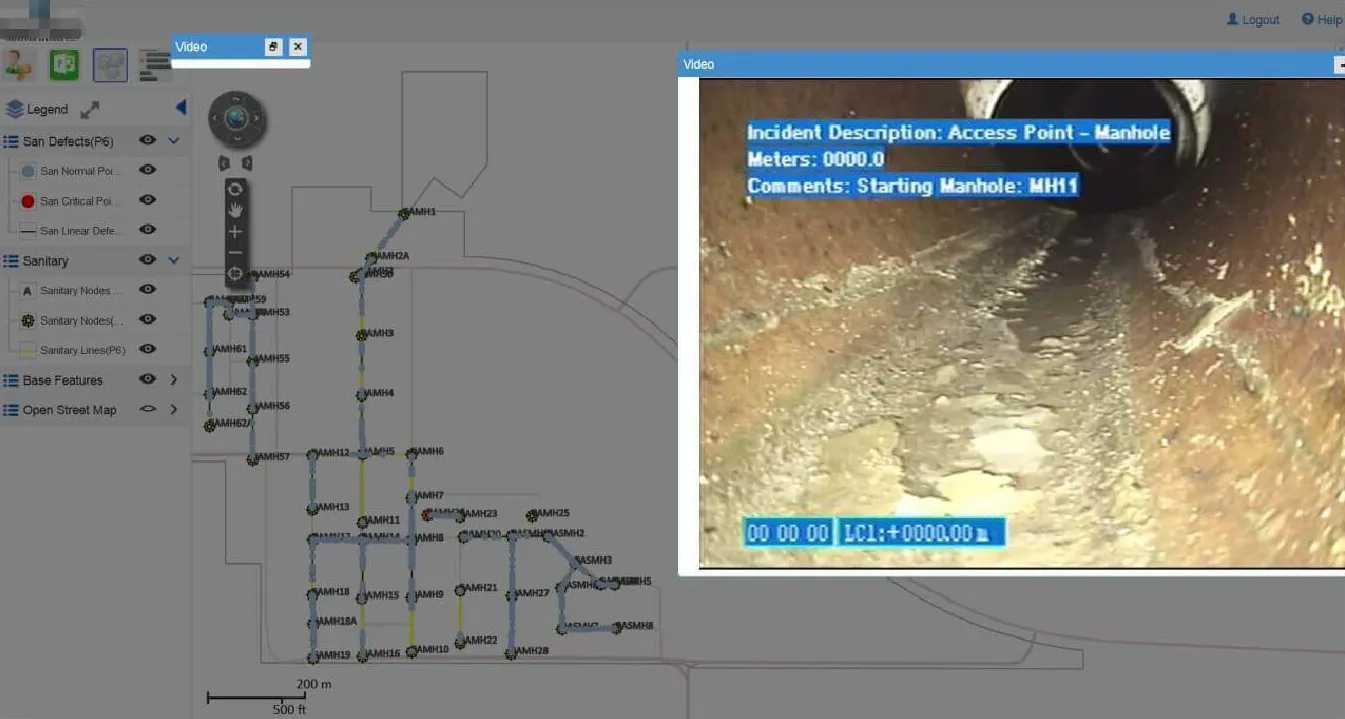
Sewer Inspection Video
Link sewer CCTV inspection video and standard PACP data to the pipes on your map. Click a location on a pipe and the inspection video starts playing from that spot.
Learn more →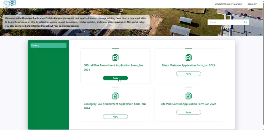
MRF Public Submission Portal
A branded online portal where residents and developers submit applications, licences, permits and more, then track progress, upload documents, pay fees and talk to staff, while every submission lands directly in your staff workflow.
Learn more →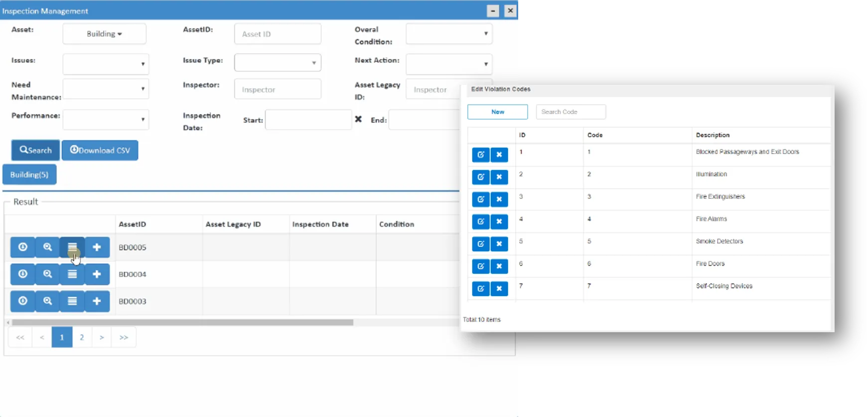
Building Inspections & Enforcement
Manage inspections for every municipal department, from request and assignment to results and follow-up, and escalate to enforcement with evidence, orders and prosecution-ready reports when compliance isn't met.
Learn more →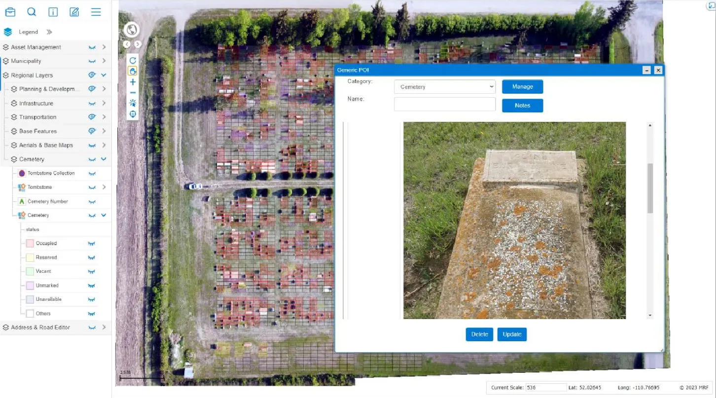
Cemetery Map
Map every plot and keep interment, ownership and availability records in one place, with an optional public search to help families find a loved one.
Learn more →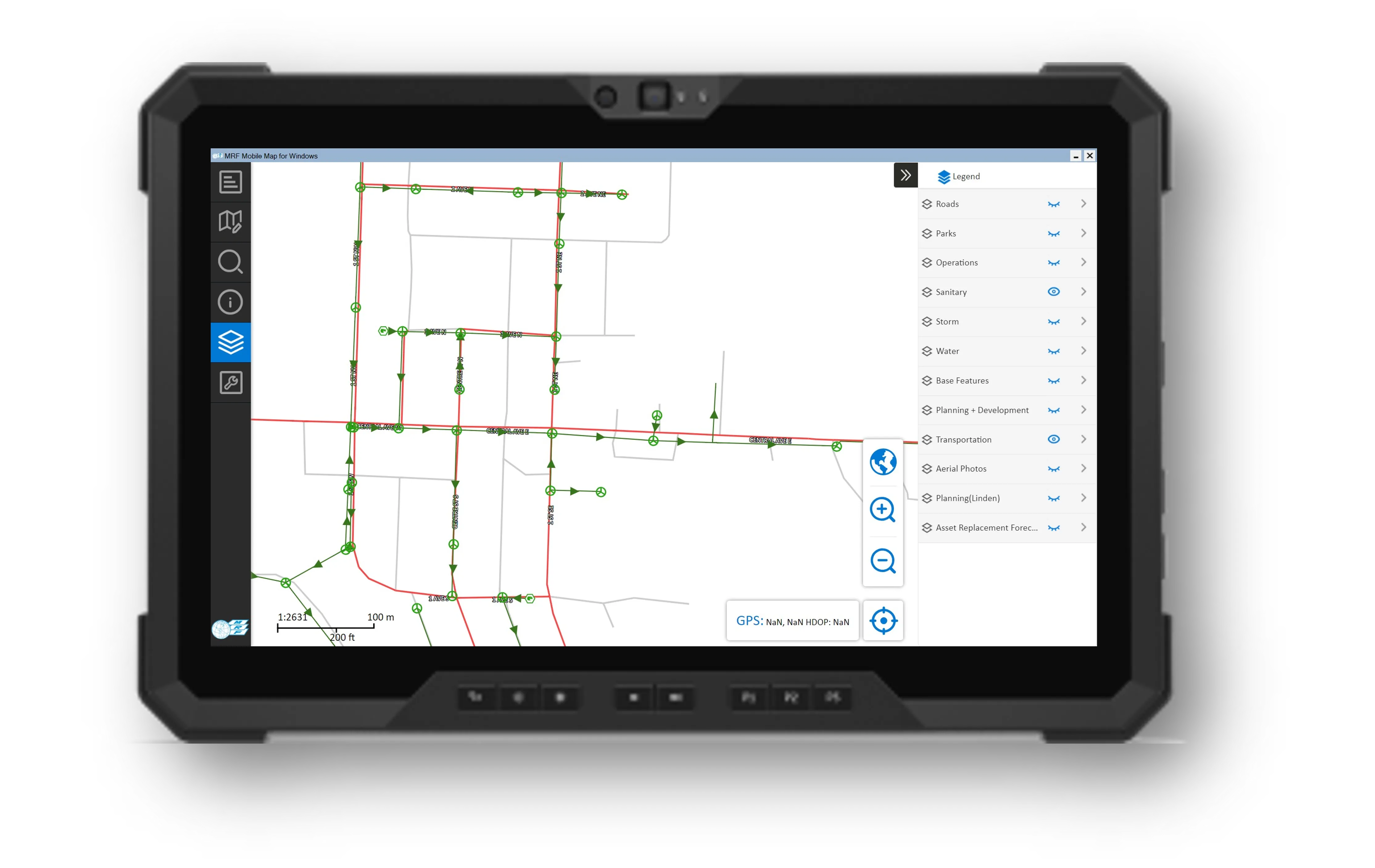
MRF Mobile GIS
Take your GIS into the field: a fast Windows client for full map access and a field collector for phones and tablets, plus the Mobile for Drivers App for operators in the cab.
Learn more →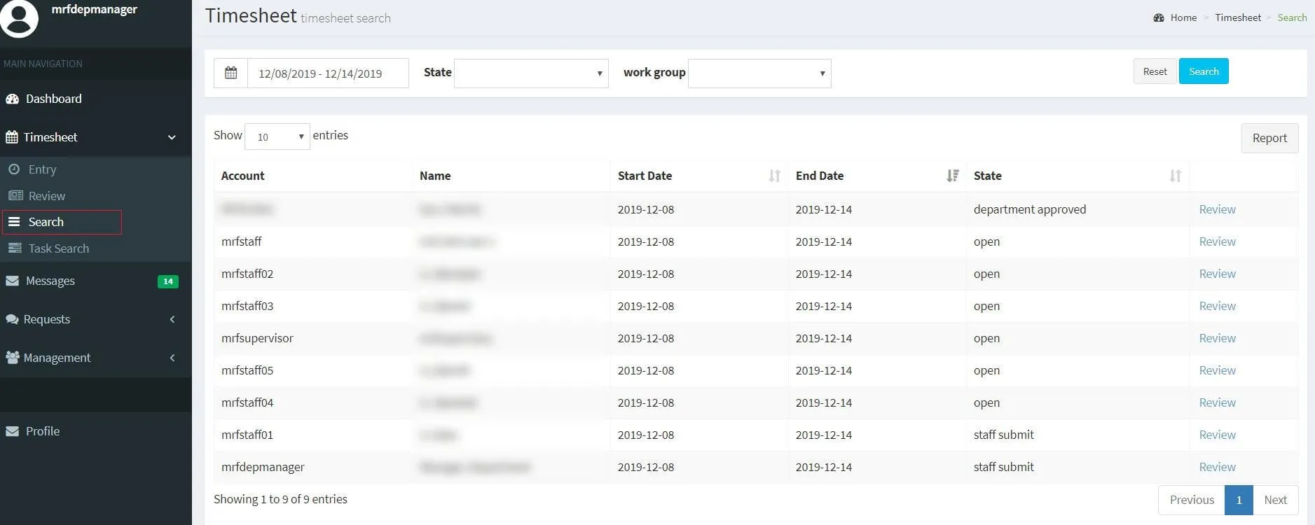
MRF Timesheet
Staff enter time online, managers review and approve, and payroll gets clean, searchable records, with overtime and banked time (TOIL) tracked automatically.
Learn more →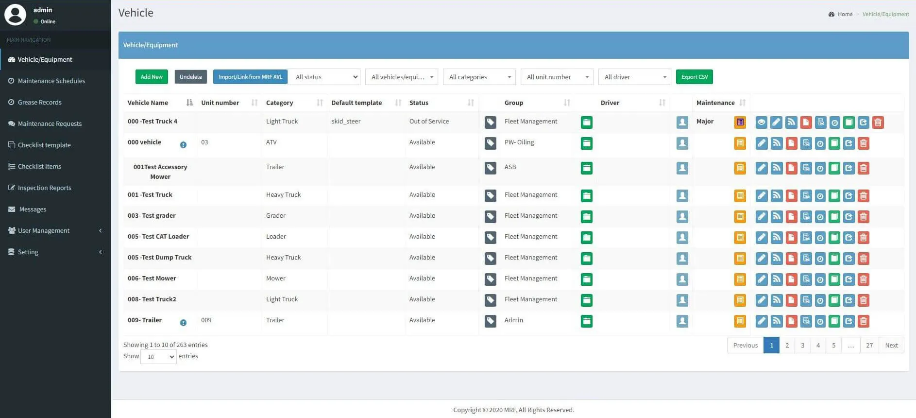
MRF Vehicle Inspection
Drivers check out vehicles and complete pre-trip inspections on a phone, even offline. Managers review deficiencies, approve repairs and stay compliant from the web.
Learn more →
AI Voice Agent
A specialized AI voice agent for municipalities and enforcement agencies. It answers calls, takes bylaw complaints, handles safety timer check-ins and records road event reports, so staff can focus on the work that needs them.
Learn more →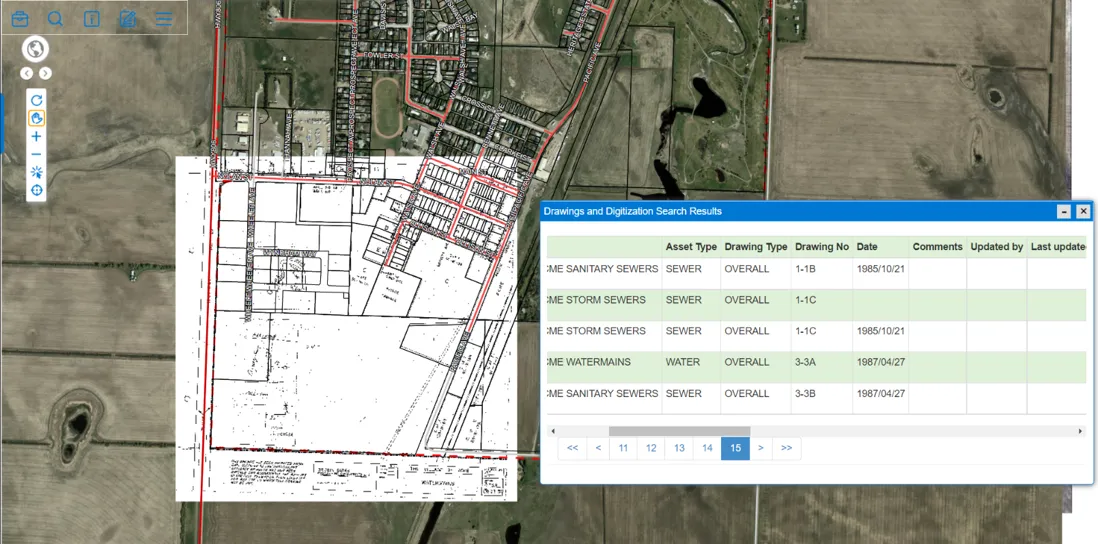
Document Management
Organize drawings, permits, reports and photos by attaching them to the buildings, assets and parcels they describe, then find them by text, feature type, or a click on the map.
Learn more →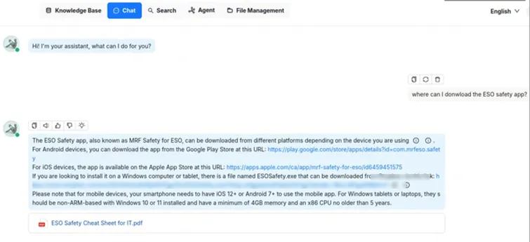
MRF DocRetrieve
MRF DocRetrieve answers staff questions from your internal knowledge base. Before it answers, it looks up your internal documents or private database, so answers are grounded in your own content, with the source attached.
Learn more →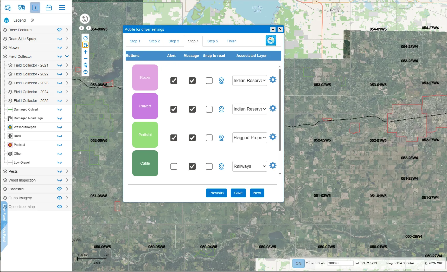
Mobile for Drivers App
Built for operators of graders, mowers and other municipal vehicles. Report road, sign and hazard issues in a tap, see recent activity on the roads you travel, and get warned about culverts, rocks and other obstacles ahead.
Learn more →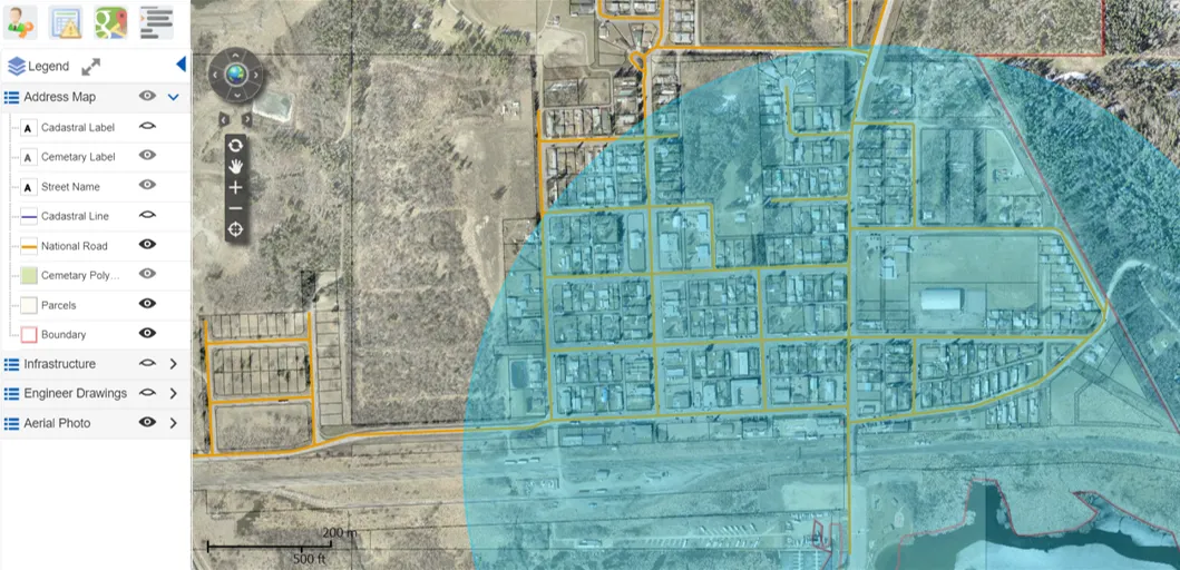
Emergency Notification Module
Draw a boundary on the map to send emergency notifications by text-to-voice phone call, SMS or email. No call lists to build, no addresses to look up.
Learn more →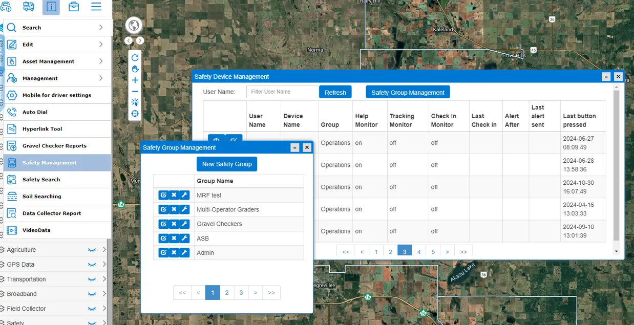
MRF Safety Lite
Check-in timers, SOS alarms and location sharing for lone workers, with satellite device support where there's no cell service. Formerly known as MRF Work Alone.
Learn more →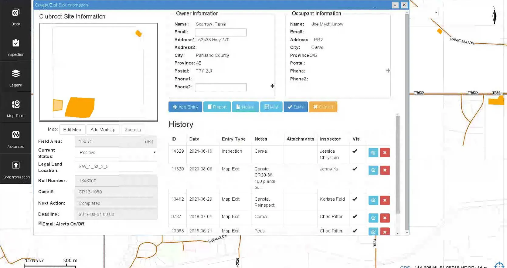
Pest Inspection
Survey and inspect for agricultural pests and diseases on a Windows tablet in the field, with every result mapped, time-stamped and ready for reporting.
Learn more →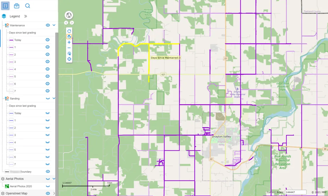
Public Gravel Map
A public map, built from your vehicle tracking data, that colours every road by the days since it was last gravelled or sanded. In winter, residents can see at a glance which roads have been cleared and which haven't.
Learn more →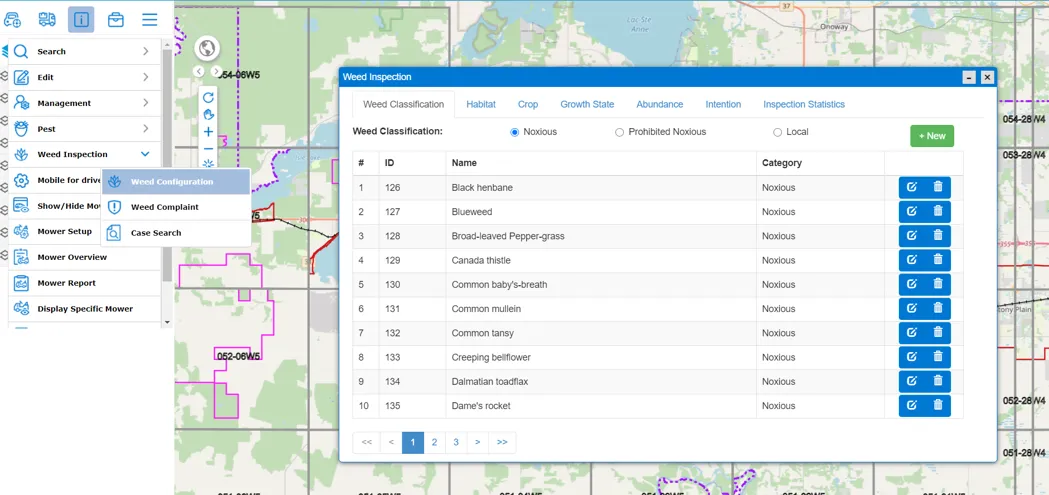
Weed Inspection
Inspectors map weed infestations in the field with GPS, record species, growth stage and habitat from pick lists, and sync to MRF Web Map, where administrators configure the program, manage complaints and search cases.
Learn more →
“Westlock County has been using the MRF-developed and maintained GIS website since 2012. The GIS and AVL offer very advanced capabilities and are very easy to use. We have achieved better productivity in all departments, including Public Works, Utilities, Planning and Fire Services.”
More solutions
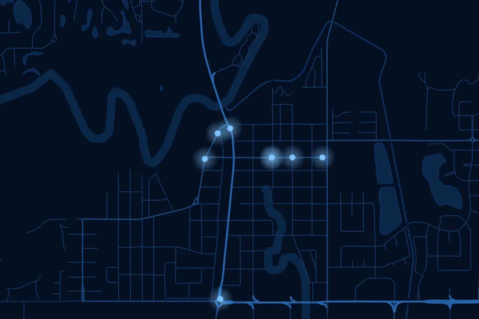 EnforcementTicketing, records and penalties in one platform, built with officers for officers.
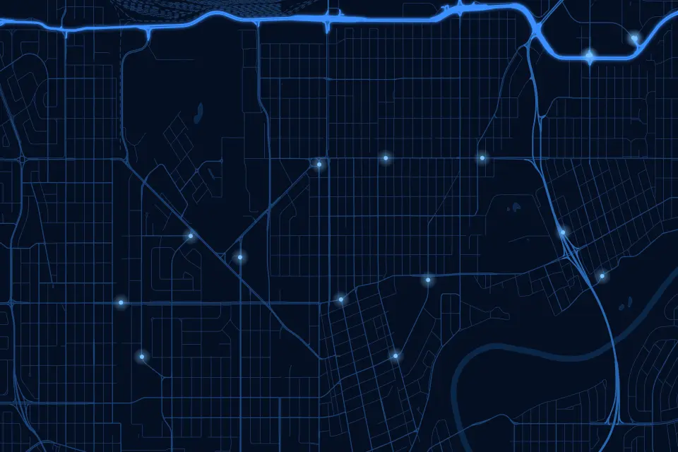 Vehicle TrackingAVL hardware, real-time tracking and fleet records on your own municipal map.
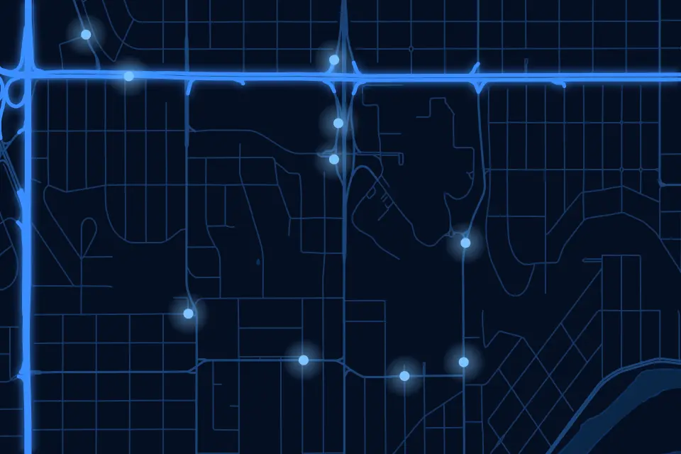 Safety & DispatchMonitoring, dispatch and lone-worker safety, even where there's no cell coverage.
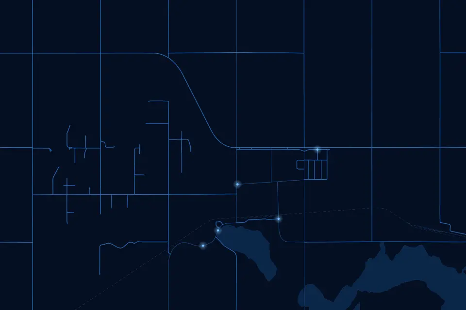 AgriculturalField record-keeping for weed, pest, mowing and spray programs.
See it working with your own data.
Book a demo and we’ll walk you through the products that fit your departments, configured for organizations like yours.