

Cemetery Map
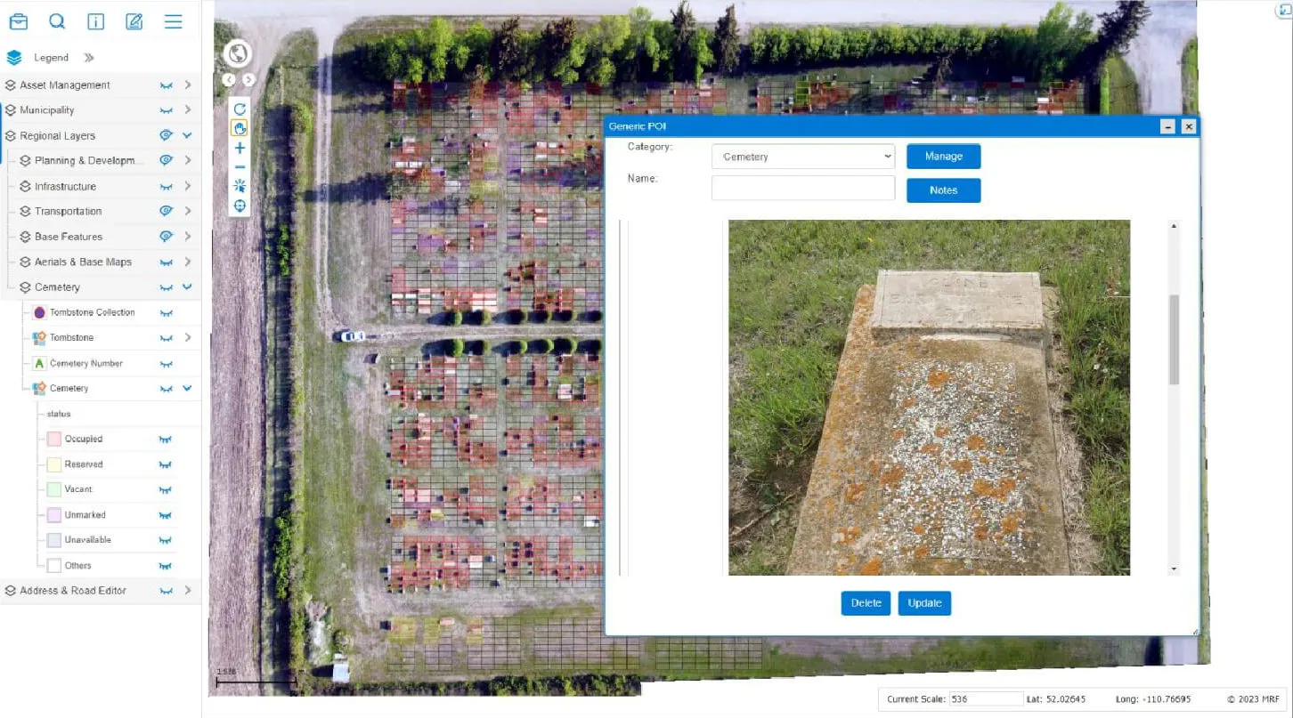
Map every plot and keep interment, ownership and availability records in one place, with an optional public search to help families find a loved one.
Cemetery records are often split between paper ledgers, spreadsheets and hand-drawn plans. MRF Cemetery Map brings them together on the map. Staff can manage plots and interments confidently, and families get the answers they’re looking for quickly.
Above: Plot-level cemetery map over aerial imagery.
What you can do with Cemetery Map
Every plot mapped
Sections, rows and plots drawn accurately on aerial imagery, with status shown at a glance.
Records attached
Interment details, plot ownership and supporting documents linked to each plot.
Find availability fast
Search for available plots by section or type when families call.
Public search (optional)
Let residents look up a name and see the plot location on a map.
Works well with


See it working with your own data.
Book a demo and we’ll walk you through the products that fit your departments, configured for organizations like yours.