
AVL hardware, real-time tracking and fleet records on your own municipal map.
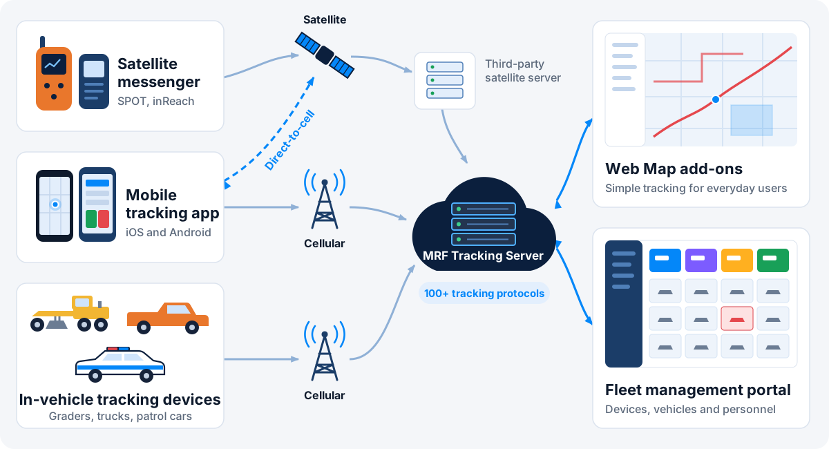
Redefine efficiency, security and operational excellence for your fleet. The MRF Vehicle Tracking Solution covers everything from rugged in-vehicle hardware to real-time monitoring, reporting and fleet management. It runs on the same municipal map your staff already use, so a vehicle’s location always comes with the roads, addresses and assets around it.
Two ways to use tracking
MRF provides two forms of tracking portal, so every user gets the right tool.
Tracking module in MRF Web Map
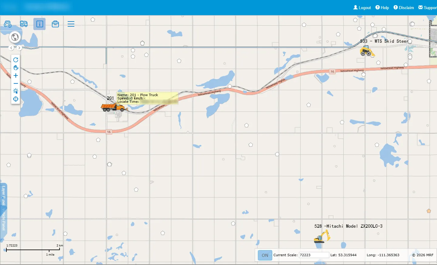
A simple interface for day-to-day users. See where vehicles are, replay trips and run reports on the same map as your roads, addresses and assets.
See the MRF Vehicle Tracking Module, and Enforcement Vehicle Tracking, which builds on it for enforcement fleets.
Dedicated fleet management portal
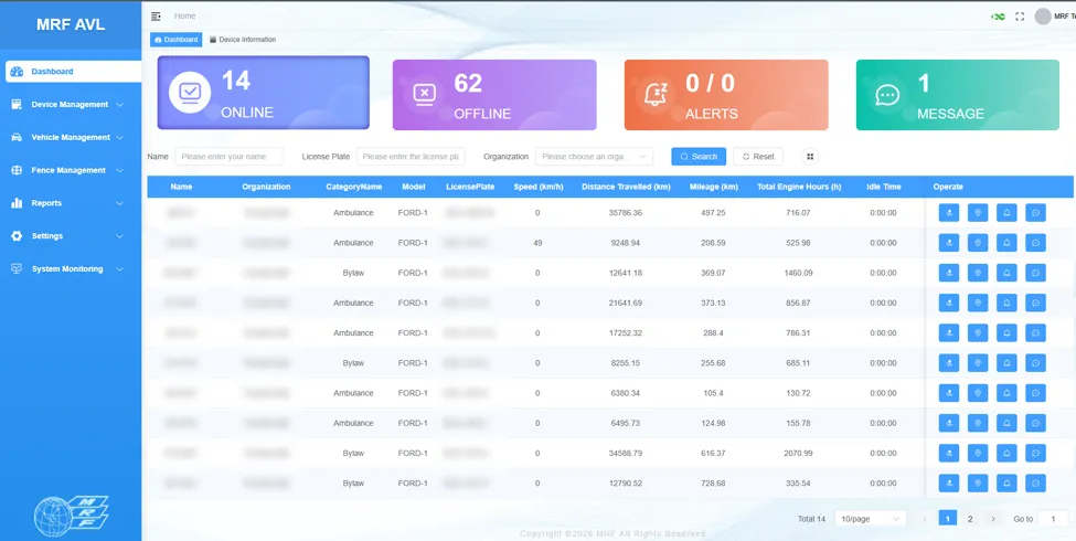
A complete workspace for fleet managers, covering tracking devices, vehicles and personnel in one place. View real-time locations, review historical tracks, assign destinations, generate routes and manage users through a role-based platform.
See the MRF Fleet Management Portal.
Tracking hardware
MRF offers multiple hardware options, and supplies, installs and supports the in-vehicle hardware. The MRF tracking server supports over 100 tracking protocols, so it works with devices you may already have. For example, the InHand VG710 in-vehicle router offers:
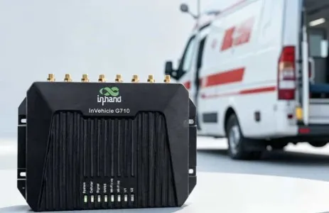
- In-cab Wi-Fi and Gigabit Ethernet connectivity
- Multiple inputs and outputs (I/O)
- OBD or J1939 vehicle connection
- Reliable operation in harsh environments
- GPS, BeiDou, Galileo and GLONASS positioning
The MRF Dual-box: LTE and Starlink
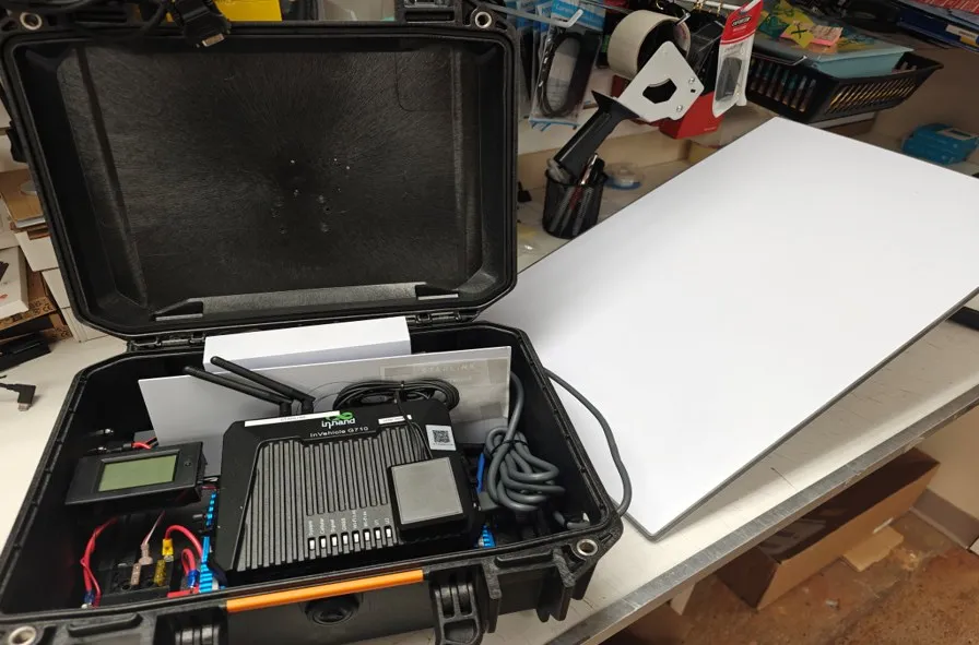
Our hardware specialists built the Dual-box, which switches automatically between an LTE modem and a Starlink satellite connection. Vehicles and crews stay connected and tracked even where there’s no cell coverage.
More in-vehicle hardware
- Tracking dashcams that record video and report location. See Tracking Cam.
- Keyless box for phone-based vehicle access and driver ID. See Fleet Keyless Entry.
Why choose the Vehicle Tracking solution
Two ways to track
A simple tracking module in MRF Web Map for everyday users, and a dedicated fleet management portal for fleet managers.
Multiple hardware options
Choose from multiple in-vehicle hardware options, supplied and supported by MRF, from rugged routers and trackers to dashcams and the Dual-box.
Over 100 tracking protocols
The MRF tracking server supports over 100 tracking protocols, so it works with the devices you already have.
Connected anywhere
The MRF Dual-box switches automatically between LTE and Starlink satellite, keeping vehicles online beyond cell coverage.
Tracking as spatial data
Positions are stored as GIS data, so you can ask where vehicles went, not just where they are. Snow-plow coverage, for example.
One fleet, many departments
Distinct icons, layers and permissions for each department, all on one platform.
Products in the Vehicle Tracking solution
Use them on their own or together. They share the same map, users and data.
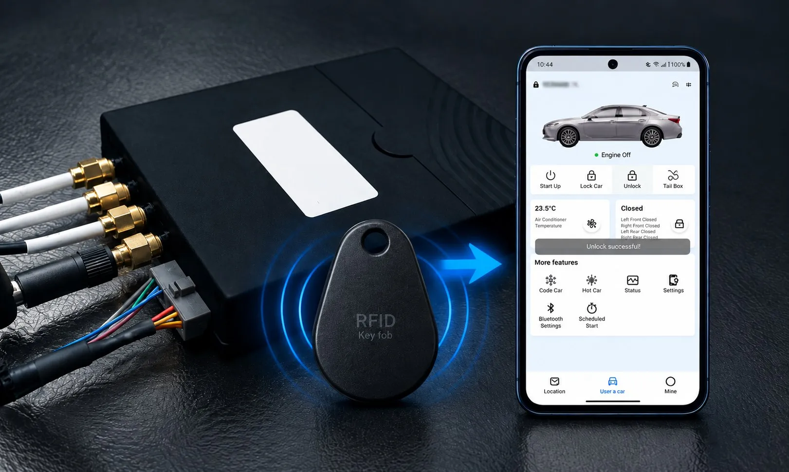
Fleet Keyless Entry
Replace keys and RFID fobs with your phone. Fleet managers assign drivers to vehicles in real time, drivers unlock and start the vehicle with the app or NFC, and the system always knows who is driving.
Learn more →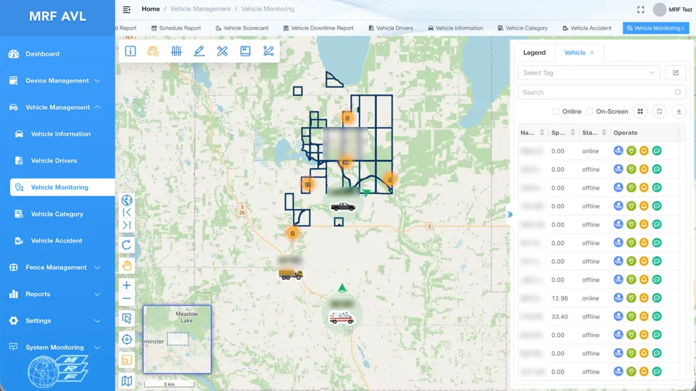
MRF Fleet Management Portal
See where every vehicle is in real time, review historical tracks, assign destinations, generate routes and look up addresses, and manage tracking devices, users and vehicles, all in one role-based portal.
Learn more →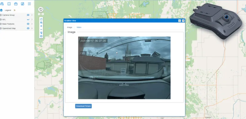
Tracking Cam
Tracking dashcams report location like any AVL device and send photos and video to the MRF server periodically, on request, or before and after events, so you can see what a vehicle sees right from the map.
Learn more →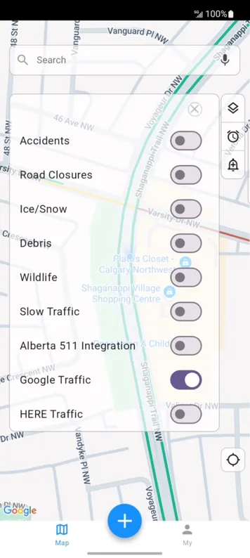
Journey Management App
MRF JMS plans compliant truck routes around your vehicle's width and height, warns drivers 2 km ahead, and lets them report road issues by voice, text or tap, all on HERE maps with Alberta 511 traffic and MSC GeoMet weather.
Learn more →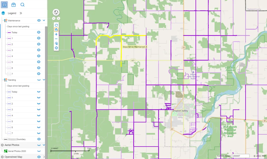
Public Gravel Map
A public map, built from your vehicle tracking data, that colours every road by the days since it was last gravelled or sanded. In winter, residents can see at a glance which roads have been cleared and which haven't.
Learn more →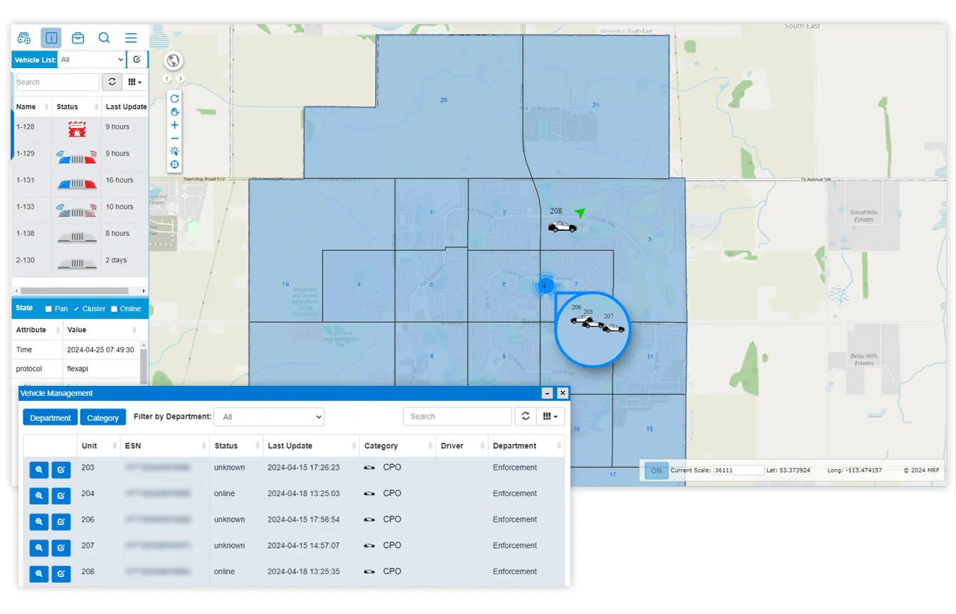
Enforcement Vehicle Tracking
GNSS tracking with SOS alerts, lights-and-sirens monitoring, rugged in-vehicle Wi-Fi and position updates as often as every two seconds, on your own municipal map.
Learn more →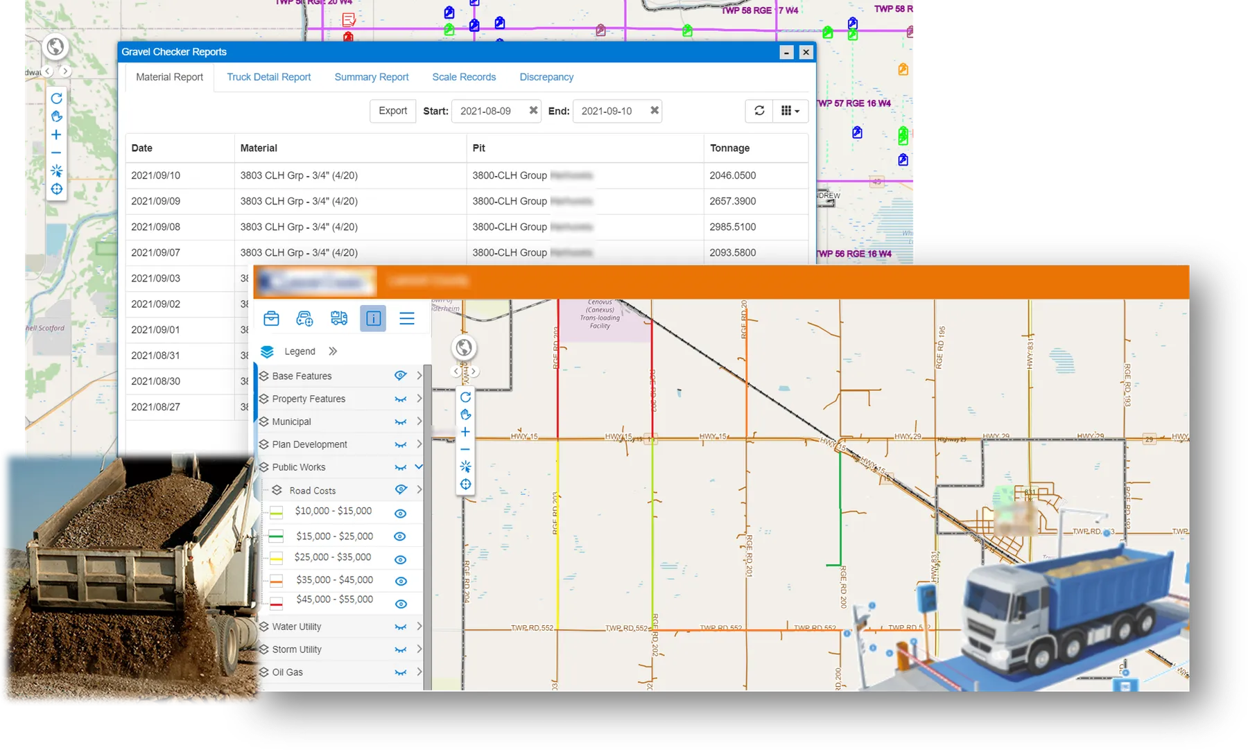
Gravel Checker App
A Windows app that works together with your MRF Web Map configuration. It can integrate with your gravel scale system and automatically calculate the gravel each truck carried and dumped on the road, so by the end of the day managers know how much tonnage went on which road segments.
Learn more →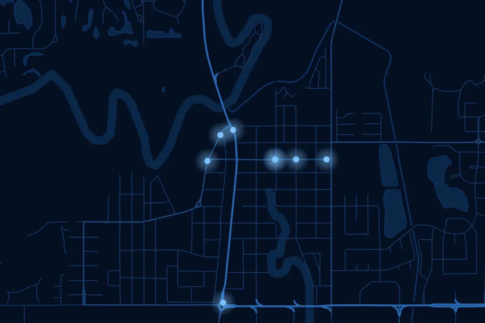
MRF Navigation
Voice-guided, offline navigation built on your municipality's authoritative road network and addresses, including the rural roads and new subdivisions consumer apps get wrong.
Learn more →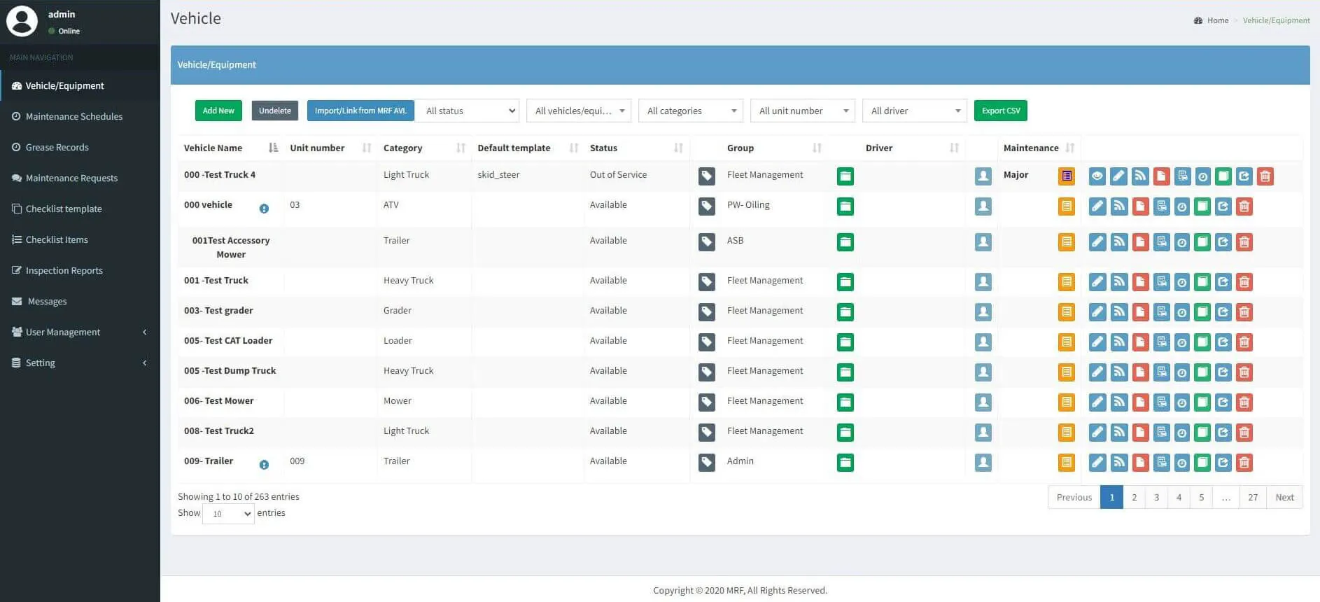
MRF Vehicle Inspection
Drivers check out vehicles and complete pre-trip inspections on a phone, even offline. Managers review deficiencies, approve repairs and stay compliant from the web.
Learn more →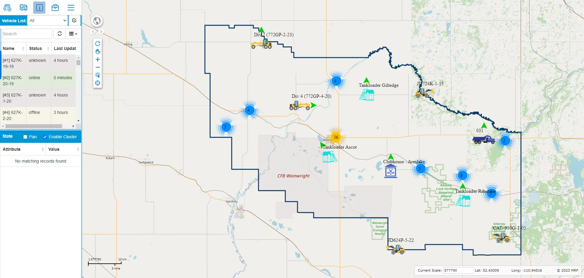
MRF Vehicle Tracking Module
A tracking module for MRF Web Map. Everyday users see every grader, plow and truck live alongside your roads, addresses and assets, replay where vehicles have been, and prove service coverage with spatial reports.
Learn more →More solutions
 Safety & DispatchMonitoring, dispatch and lone-worker safety, even where there's no cell coverage.
 AgriculturalField record-keeping for weed, pest, mowing and spray programs.
 FireAccurate maps, fast call-outs and complete records for fire departments.
 AirportSmart maps and geospatial tools for airport planning and operations.
See it working with your own data.
Book a demo and we’ll walk you through the products that fit your departments, configured for organizations like yours.