
Enforcement Vehicle Tracking
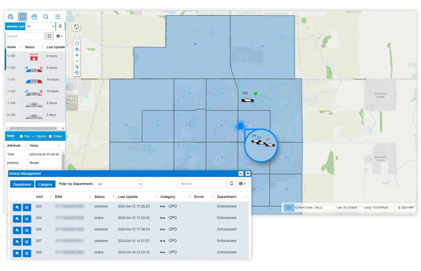
GNSS tracking with SOS alerts, lights-and-sirens monitoring, rugged in-vehicle Wi-Fi and position updates as often as every two seconds, on your own municipal map.
Drawing on 30 years of mapping expertise, MRF provides real-time GNSS tracking transmitted to dedicated monitoring centres and partner organizations. It serves rural and urban municipalities across Canada.
Where MRF Vehicle Tracking Module focuses on fleet operations and service coverage, Enforcement Vehicle Tracking is built around the officer: safety alerts, emergency-equipment status and reliable connectivity in the vehicle.
Above: Live enforcement fleet on your municipal map.
What you can do with Enforcement Vehicle Tracking
Officer safety first
Optional SOS alerts plus monitoring of critical systems such as lights and sirens.
Precision when it matters
Most agencies report every 30 seconds; increase to every 2 seconds en route and every 2 hours when parked.
Connected patrol vehicles
Rugged modems with in-vehicle Ethernet, Wi-Fi (up to 100 Mbps) and cellular signal boosting keep officers online.
Your municipal map
Click a road segment or address to see its attributes, from owner details to schools and commercial buildings.
Searchable records
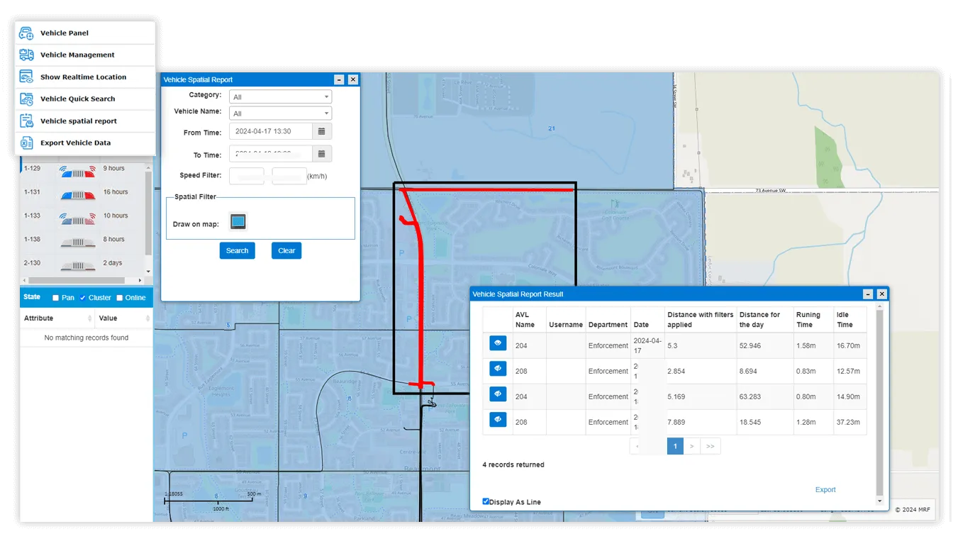
Search vehicle history by unit, date range or zone, with complete, reliable movement records.
Multi-department
Distinct icons and layers for each department, plus integration with vehicle sensors.
A closer look
Works well with
MRF Vehicle Tracking Module
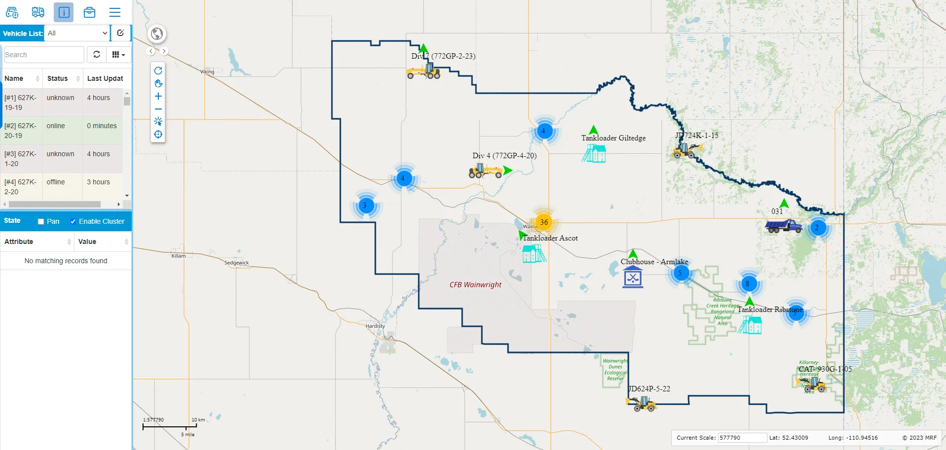
Simple, real-time vehicle tracking built into MRF Web Map.
Learn more →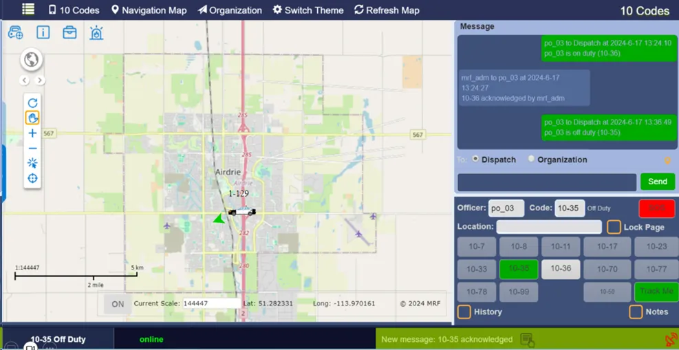
MRF Safety Pro
An advanced, professional-grade safety system for officers, responders and their vehicles.
Learn more →
MRF E-Ticketing
Issue bylaw and provincial tickets anywhere, online or offline.
Learn more →
See it working with your own data.
Book a demo and we’ll walk you through the products that fit your departments, configured for organizations like yours.