
MRF Vehicle Tracking Module
A tracking module for MRF Web Map. Everyday users see every grader, plow and truck live alongside your roads, addresses and assets, replay where vehicles have been, and prove service coverage with spatial reports.
The MRF Vehicle Tracking Module adds real-time tracking to MRF Web Map. It’s the simple way to use tracking: staff who already work in the map see where vehicles are, alongside your roads, addresses and assets, without learning a separate system.
Vehicles fitted with MRF AVL devices send their location and sensor data over the cellular network to MRF’s tracking server. The module turns that raw feed into something useful: a live fleet map, searchable history, and derived GIS layers for business needs like snow removal and grading.
Unlike traditional AVL systems that store only latitude and longitude, MRF treats every tracking point as spatial data, which opens up advanced spatial analysis and reporting.
Managing a fleet day to day? The MRF Fleet Management Portal gives fleet managers a complete workspace for tracking devices, vehicles and personnel. Both are part of the MRF Vehicle Tracking Solution.
Tracking enforcement units? See Enforcement Vehicle Tracking, which adds officer-safety features like SOS, lights-and-sirens monitoring and in-vehicle connectivity.
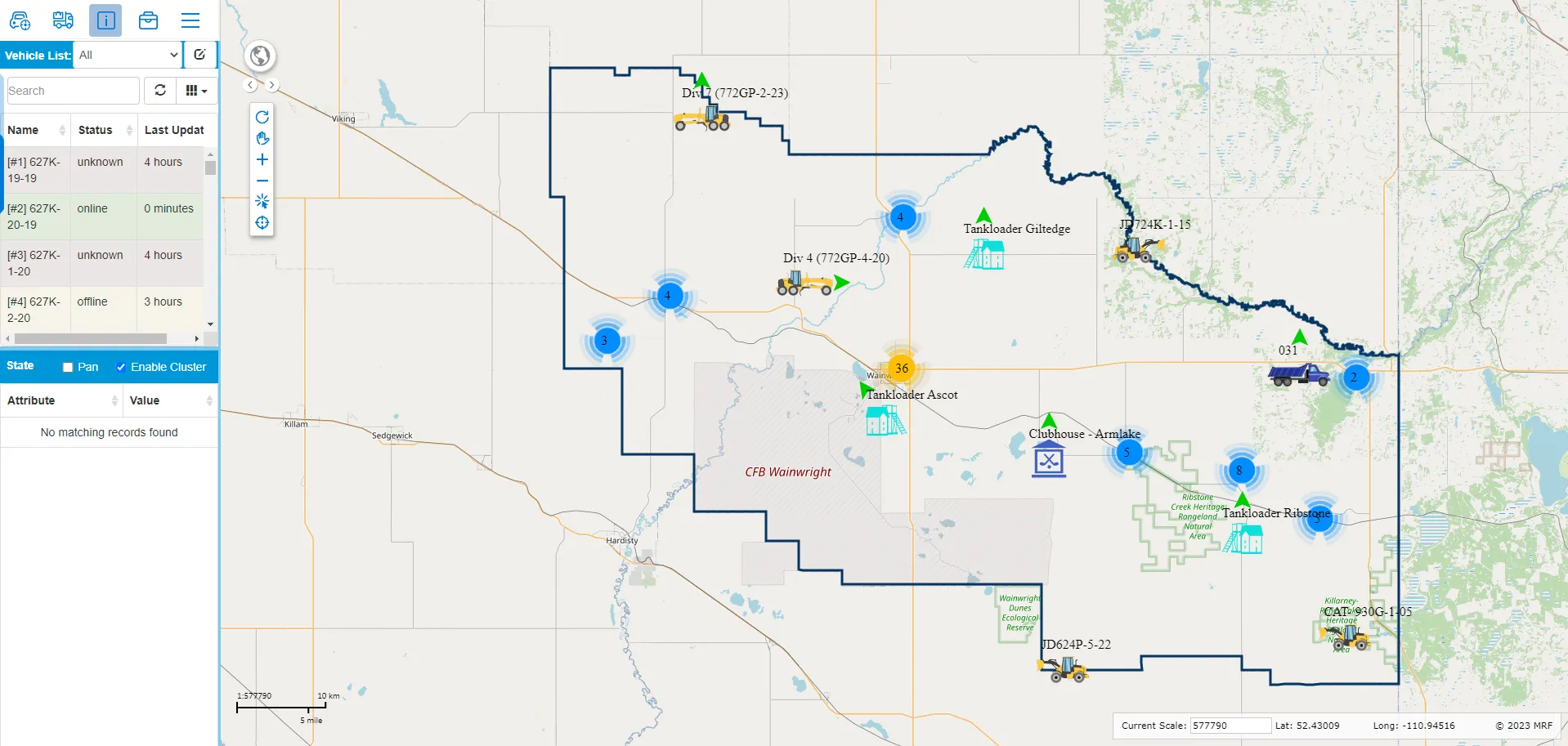
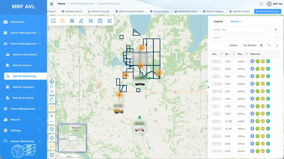
Above: Live positions on MRF Web Map, with the vehicle list and status colours.
What you can do with MRF Vehicle Tracking Module
Built into the map you already use
Tracking appears as a module in MRF Web Map, so staff see vehicles alongside roads, addresses and assets without learning a separate system.
Live fleet map
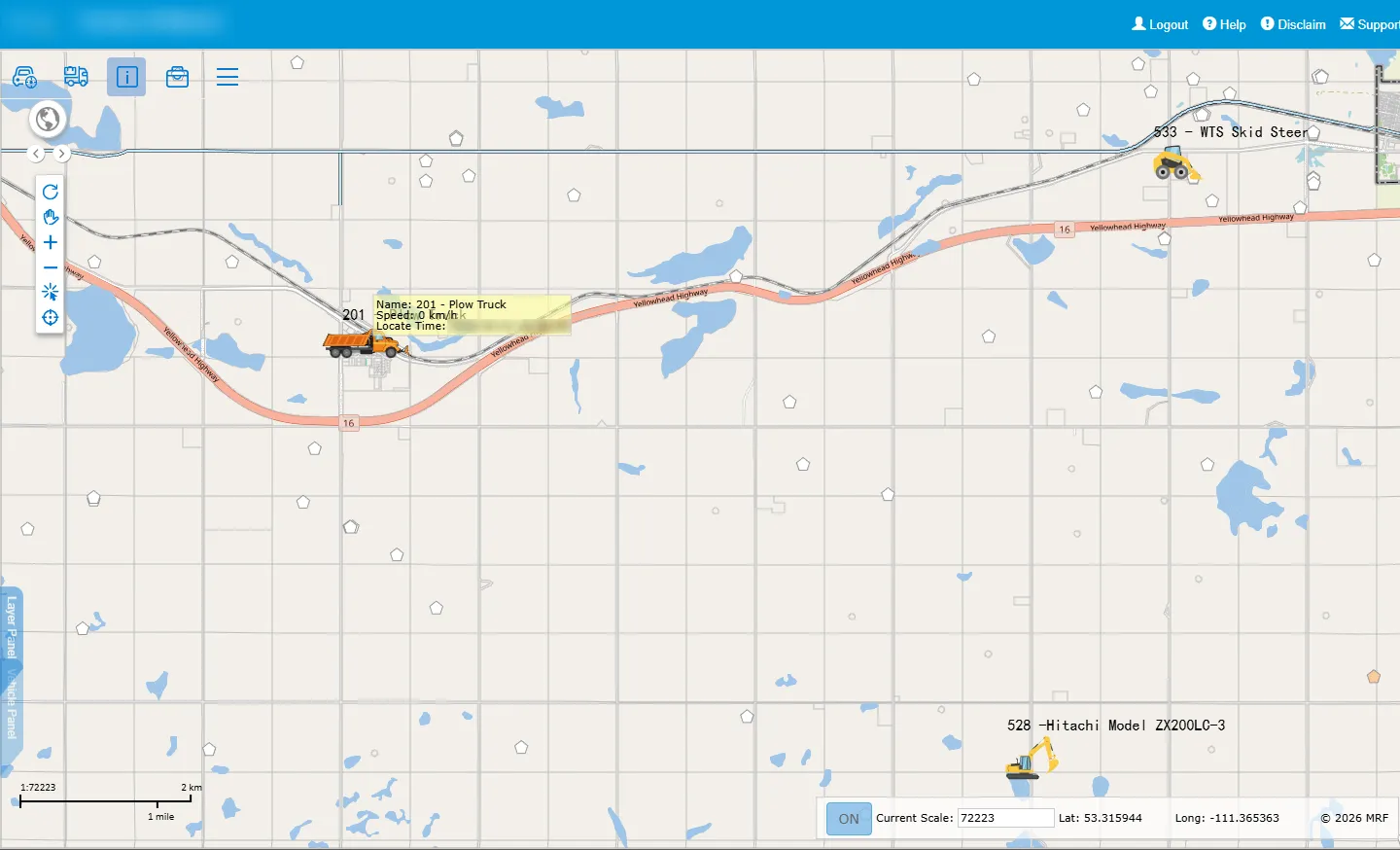
Every vehicle with direction of travel, colour-coded status (online, offline, unknown), clustering and configurable map tips for speed and time.
History and playback
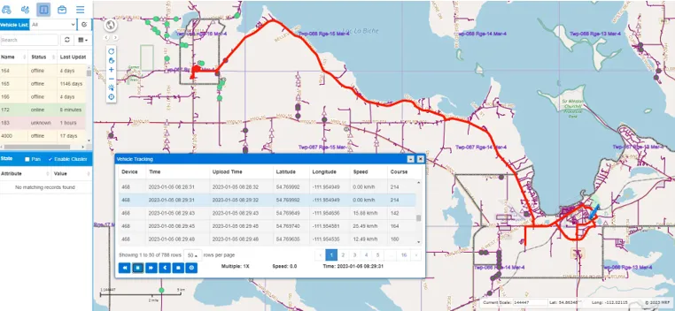
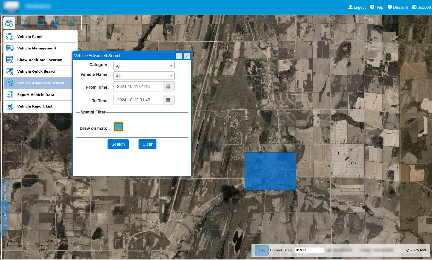
Search any vehicle by date and time, draw its path as a line and play back the trip with speeds.
Spatial reports
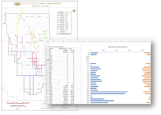
Ask which vehicles worked inside an area and when. Tracking points are stored as spatial data, so you can, for example, generate snow-removal coverage layers.
Departments and permissions
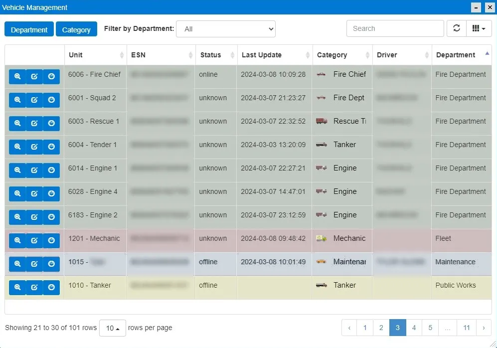
Organize vehicles into departments and categories with their own symbols, and control who sees which vehicles by role.
Exports, mileage and engine hours
Export distance travelled per vehicle and for the whole fleet to CSV, and keep odometer and engine-hour readings current for MRF Vehicle Inspection.
A closer look
Works well with


See it working with your own data.
Book a demo and we’ll walk you through the products that fit your departments, configured for organizations like yours.