

Public Gravel Map
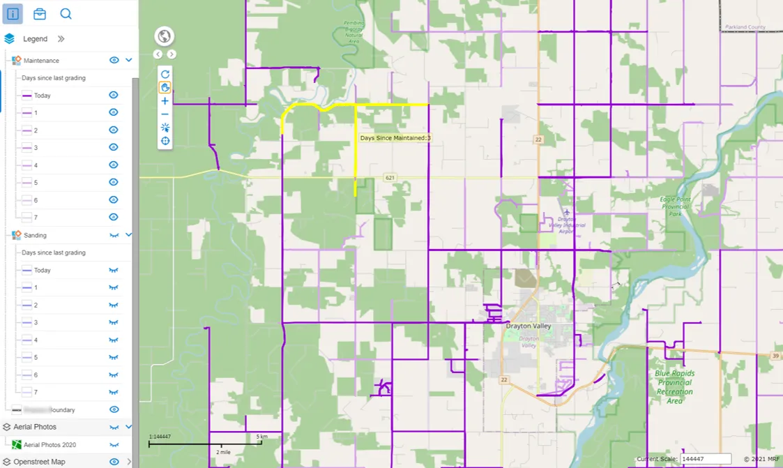
A public map, built from your vehicle tracking data, that colours every road by the days since it was last gravelled or sanded. In winter, residents can see at a glance which roads have been cleared and which haven't.
The MRF Public Gravel Map shows residents which roads have been gravelled or sanded in the last 7 days, and which haven’t. Each road is coloured by the number of days since it was last maintained, from today to seven days ago.
It’s especially helpful in winter. Residents can see at a glance which roads have been snow cleared and which are still waiting, before they head out.
The map is built from the tracking data of your graders and sanders, using the MRF Vehicle Tracking Module, and is published on MRF Web Map.
Above: Roads coloured by days since they were last maintained, from today to seven days ago.
What you can do with Public Gravel Map
The last 7 days at a glance
Roads are coloured by days since last maintained, from today to seven days ago, so it's easy to see which roads have been done and which haven't.
Gravelling and sanding
Separate layers for gravelling and sanding, each showing the days since the road was last done.
Built for winter
Residents can check which roads have been snow cleared before they head out, instead of calling the office.
Hover for details
Point at any road to see how many days it's been since it was last maintained.
Straight from vehicle tracking
The map is built from your graders' and sanders' tracking data, so it reflects where the work was actually done.
Works well with
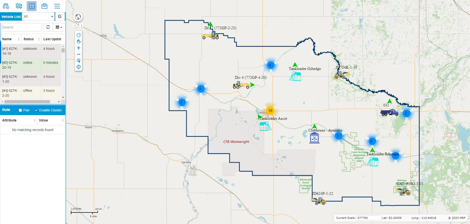
MRF Vehicle Tracking Module
Simple, real-time vehicle tracking built into MRF Web Map.
Learn more →
MRF Web Map
The browser-based GIS platform at the heart of every MRF solution.
Learn more →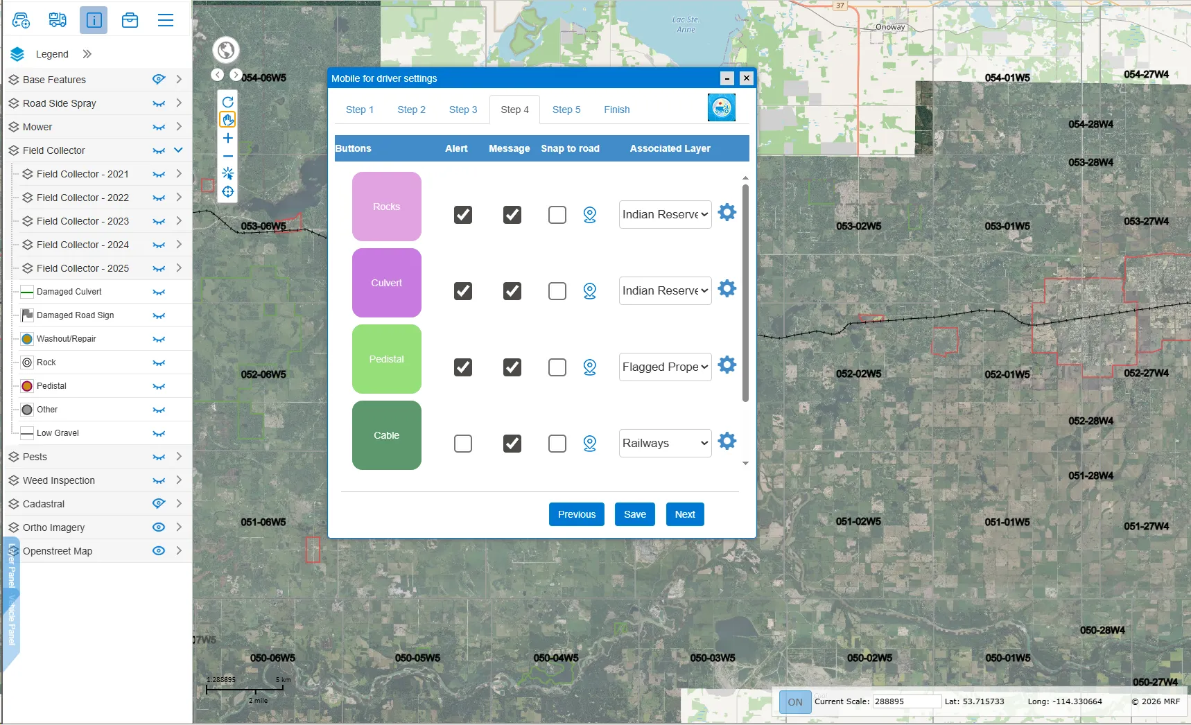
Mobile for Drivers App
In-cab app for grader, mower and truck operators: report road issues and get hazard alerts.
Learn more →
See it working with your own data.
Book a demo and we’ll walk you through the products that fit your departments, configured for organizations like yours.