
Mobile for Drivers App
Built for operators of graders, mowers and other municipal vehicles. Report road, sign and hazard issues in a tap, see recent activity on the roads you travel, and get warned about culverts, rocks and other obstacles ahead.
Operators spend their day on the road network, so they’re often the first to spot a washed-out culvert, a damaged sign or a new hazard. The Mobile for Drivers App lets them report it on the spot with a tap. It also shows recent activity on the roads they travel and warns them about obstacles ahead.
It’s part of the MRF Mobile GIS family. Reports land in the same MRF Web Map your office uses.
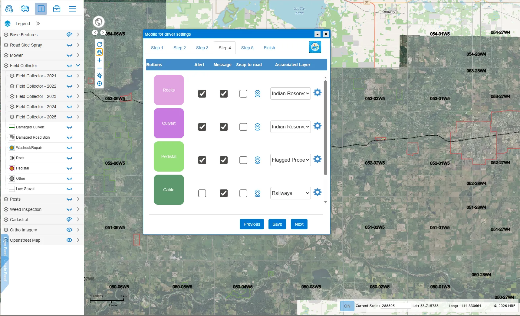
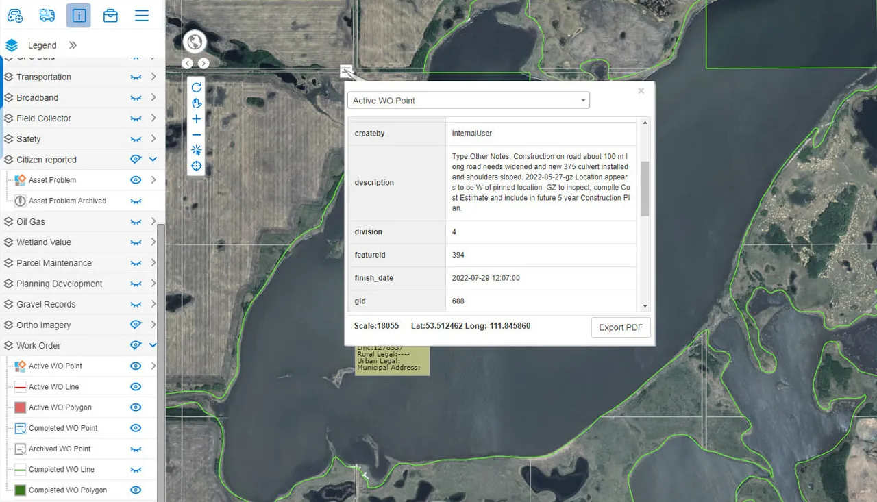
Above: Set up the drivers' buttons in MRF Web Map, choosing alerts, messages, snap-to-road and the map layer for each.
What you can do with Mobile for Drivers App
One-tap issue reporting
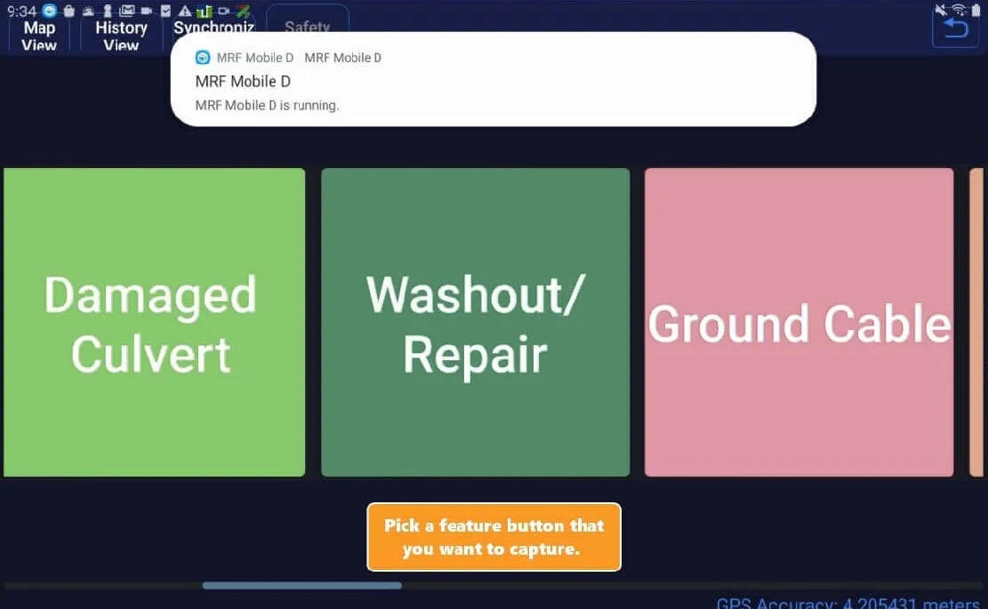
Report road conditions, sign conditions, obstacles and hazards from the cab with large, simple buttons.
Recent road activity
See recent activity on the roads you're travelling.
Obstacle alerts
The app warns operators of upcoming obstacles such as culverts and rocks before they reach them.
Phone or tablet
Runs on an Android phone or tablet mounted in the vehicle.
Configured in MRF Web Map
Supervisors set up the app's buttons in MRF Web Map, choosing alerts, messages, snap-to-road and the layer each report is saved to. Reports flow back to the same map for review.
Work-alone ready
Add Safety Lite check-ins and SOS for operators working alone.
A closer look
Works well with

See it working with your own data.
Book a demo and we’ll walk you through the products that fit your departments, configured for organizations like yours.