MRF Municipal Solution

Planning & Development

Development permits and applications, from intake to decision, on the map.
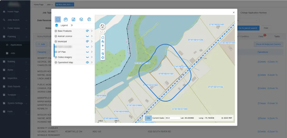
MRF Planning Portal job with a map dialog showing a notification buffer drawn around subject parcels to find adjacent owners

Manage development permits and planning applications with every parcel, landowner and referral in context. Deploy it as an add-on to MRF Web Map, or as a dedicated planning portal for your whole planning and building team.

Planning & Development was designed from scratch in partnership with our municipal clients. It puts everyday planning workflows front and centre: permits, referrals, notices and decisions all happen with the map and the parcel in view, not in a separate system.

It comes in two forms. Choose the map add-on if your planners already work in MRF Web Map, or the dedicated planning portal for a complete planning and building workspace.

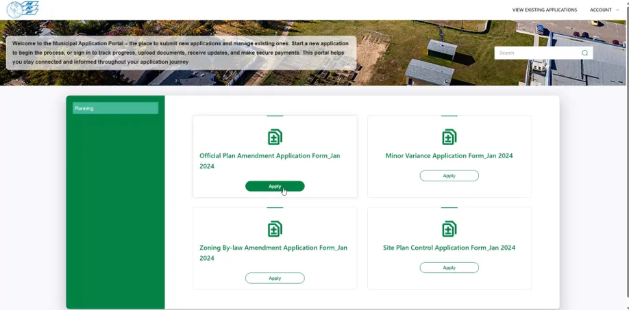
Either option can work together with the MRF Public Submission Portal, so residents and developers can submit development applications and plans online. Submissions arrive directly in your planning workflow, ready for review.

Above: A notification buffer around the subject parcels finds every adjacent owner.

Two ways to deploy it

1Map add-on

Planning inside MRF Web Map

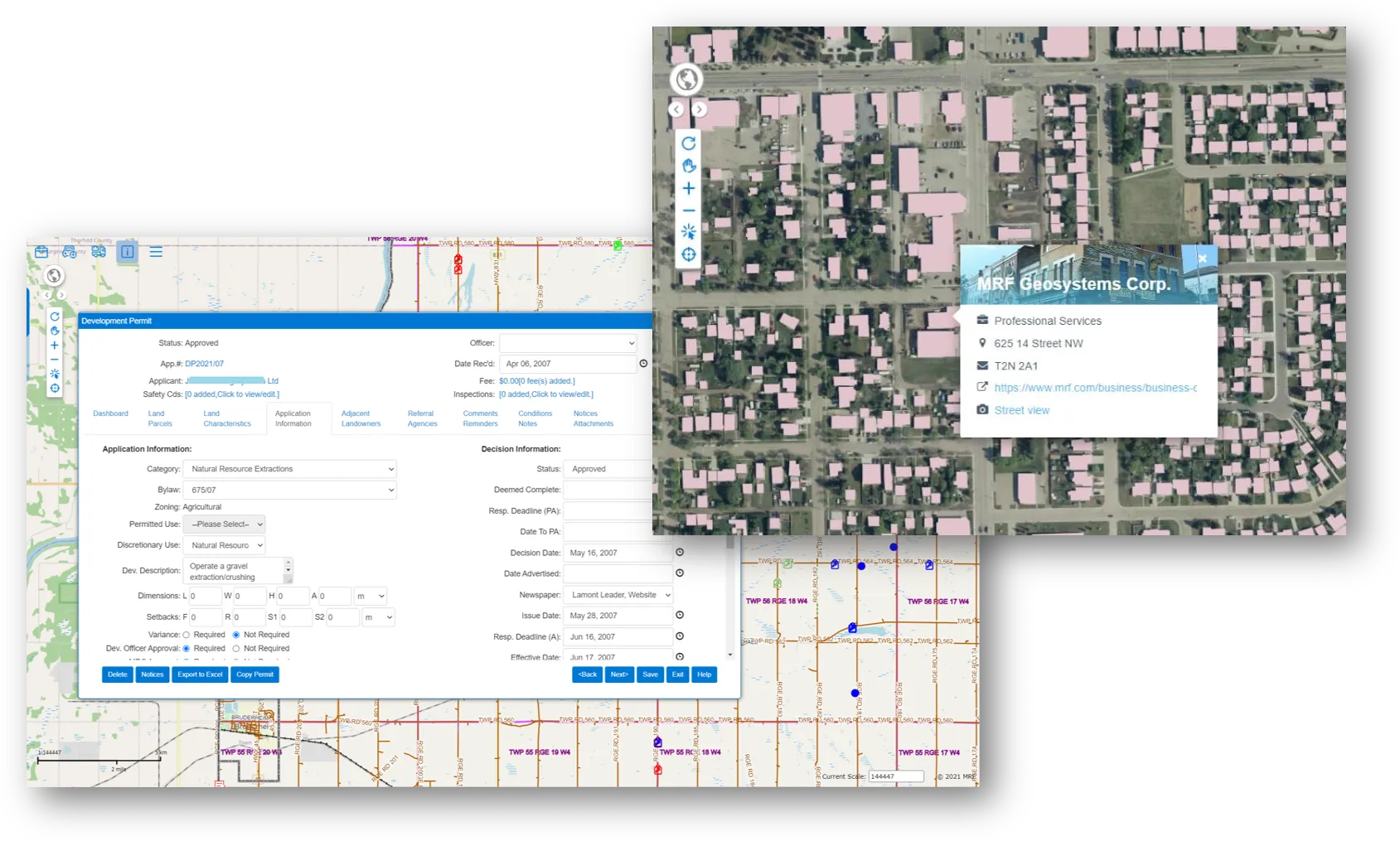
Add Planning & Development to the MRF Web Map you already use. Permits open right on the map, next to the parcels, roads and imagery your staff work with every day.

  • Development permit form with dashboard, land parcels and land characteristics tabs
  • Application and decision tracking, fees, inspections and safety codes
  • Adjacent landowners, referral agencies, conditions, notices and attachments
  • Export to Excel and copy permits

A development permit open over MRF Web Map, with application and decision information, beside a map popup for a property
2Dedicated portal

MRF Planning Portal

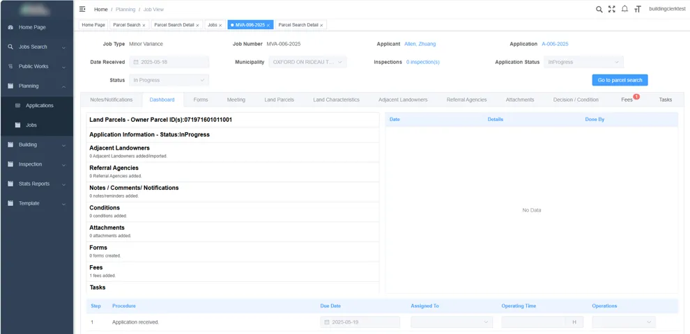
A full web portal for planning and building departments, with its own workspace for applications, jobs, building, public works, bylaw, inspections and reports, and the map built into every screen.

  • Applications and jobs with notes, notifications, fees, tasks and conditions
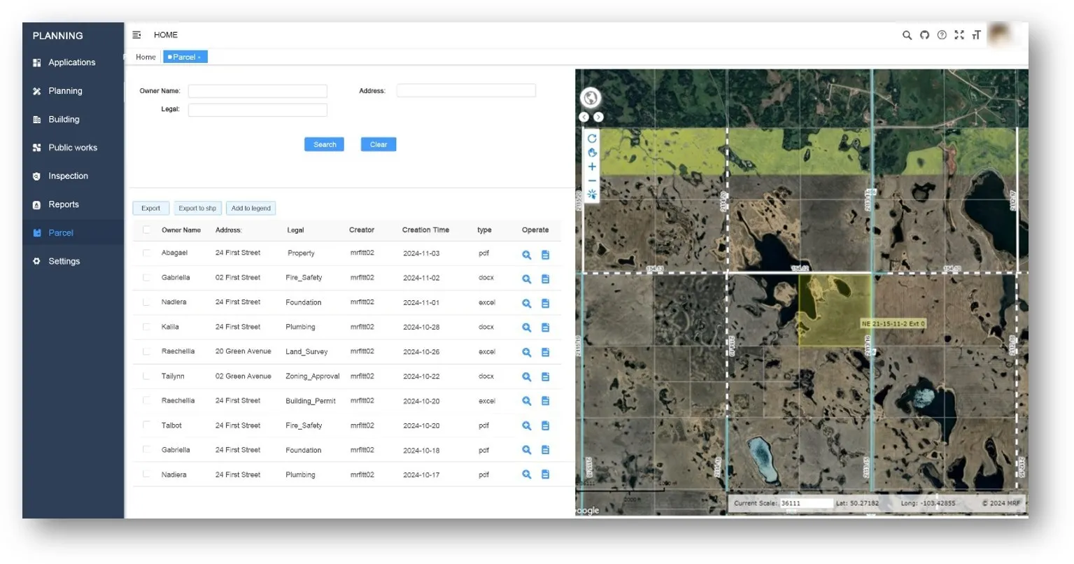
  • Parcel search by owner, address or legal description, with linked documents
  • Adjacent-owner search with a map buffer around the subject parcels
  • Stats reports, templates, forms and system settings
MRF Planning Portal parcel search, listing parcel documents beside a map of quarter sections with a selected parcel highlighted

What you can do with Planning & Development

01

Permits from the map

Create a development permit directly against a parcel, with land parcels, land characteristics and zoning filled in from your GIS.

02

The complete application file

Application and decision information, adjacent landowners, referral agencies, comments and reminders, conditions, notices and attachments in one record.

03

Adjacent owners

Use Parcel Search with a configurable buffer to quickly identify neighbouring parcels and generate a list of owner names and mailing addresses, ideal for preparing notification letters.

04

Configured to your bylaw

Set up your own land uses, zoning districts, permit categories and development options. No custom development required.

05

Search, report, export

Search applications, parcels and documents, run stats reports, and export to Excel or shapefile.

06

Public submissions

Pair with the MRF Public Submission Portal so residents and developers can submit applications and plans online, and track them through to a decision.

A closer look

Talk to us

See it working with your own data.

Book a demo and we’ll walk you through the products that fit your departments, configured for organizations like yours.