

Public Works & Infrastructure
MRF brings together the modules public works crews use every day, built on a municipal utility data model and MRF Web Map, with tools for elevation profiles and road allowance records beyond the traditional utility layers.
Public works and infrastructure teams juggle drawings, work orders, vehicles, field data and assets. With MRF, they all live on the same map, and each team uses the module built for its job:
- Document Management to manage engineering drawings.
- Work Orders to track work order progress.
- MRF Vehicle Tracking Module to view and manage the fleet.
- MRF Mobile GIS to collect data in the field.
- Asset Management to manage assets.
A municipal utility data model
MRF created a municipal utility data model to help municipal clients organize their water, sanitary, storm and other infrastructure data.
Beyond the utility layers
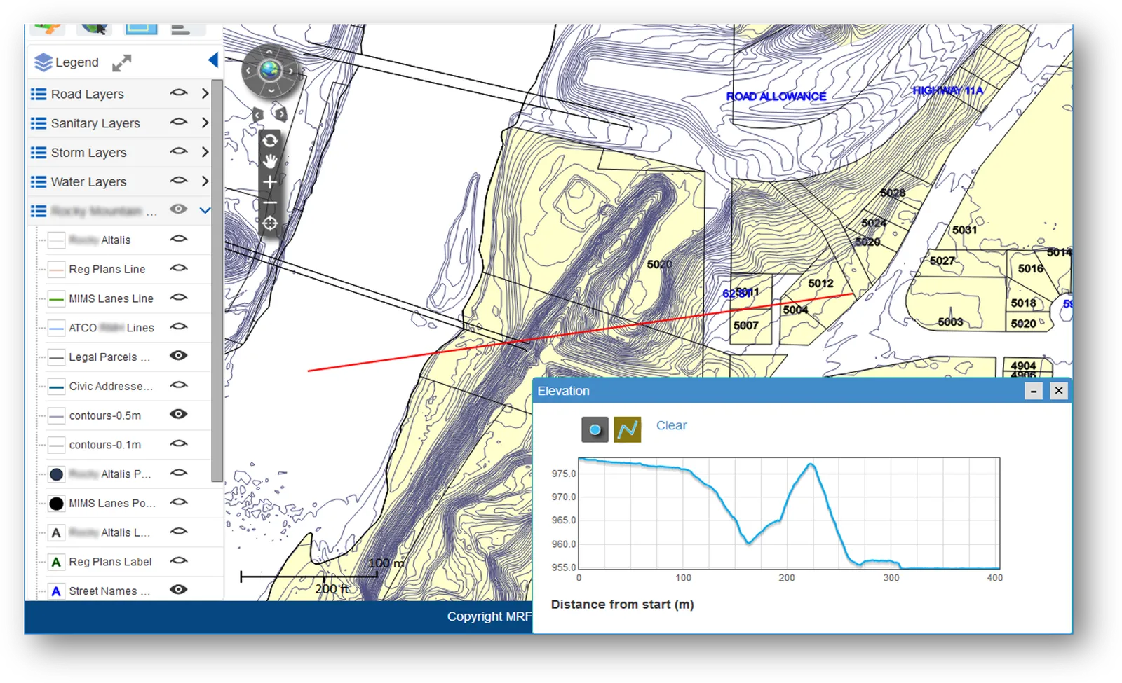
Beyond the traditional utility layers, MRF Web Map can generate elevation reports and manage road allowance records as well.
Above: Draw a line on the map to generate an elevation report.
What you can do with Public Works & Infrastructure
Engineering drawings
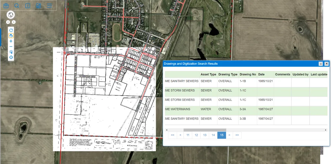
Manage engineering drawings with the Document Management module, attached to the infrastructure they describe.
Work order progress
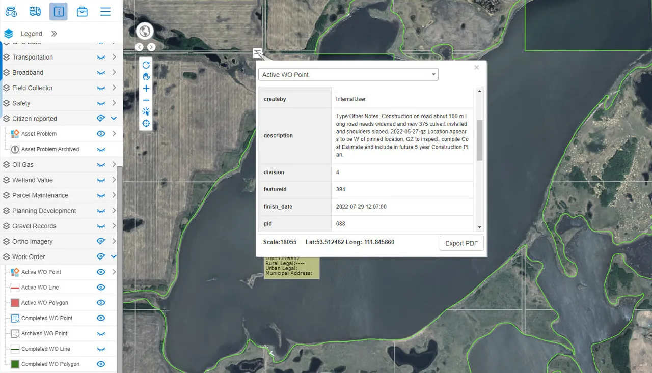
Track the progress of every work order with the Work Orders module, from assignment to completion.
Fleet
View and manage your fleet with the Vehicle Tracking module.
Field data collection
Collect data in the field with MRF Mobile GIS, and sync it back to the office.
Asset management
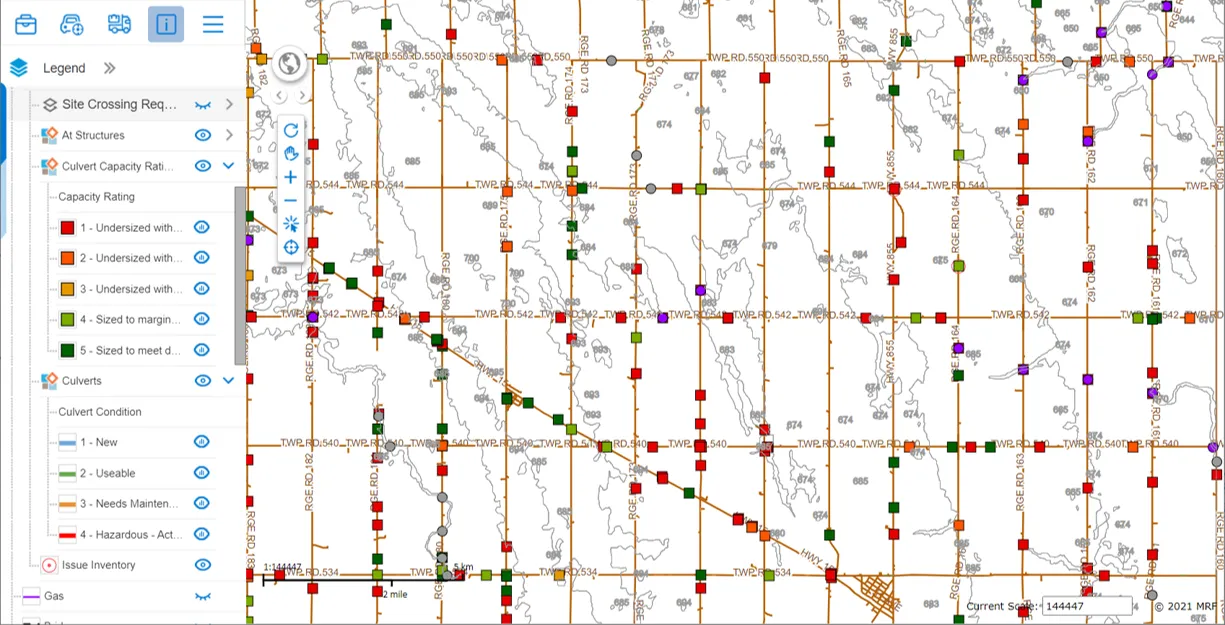
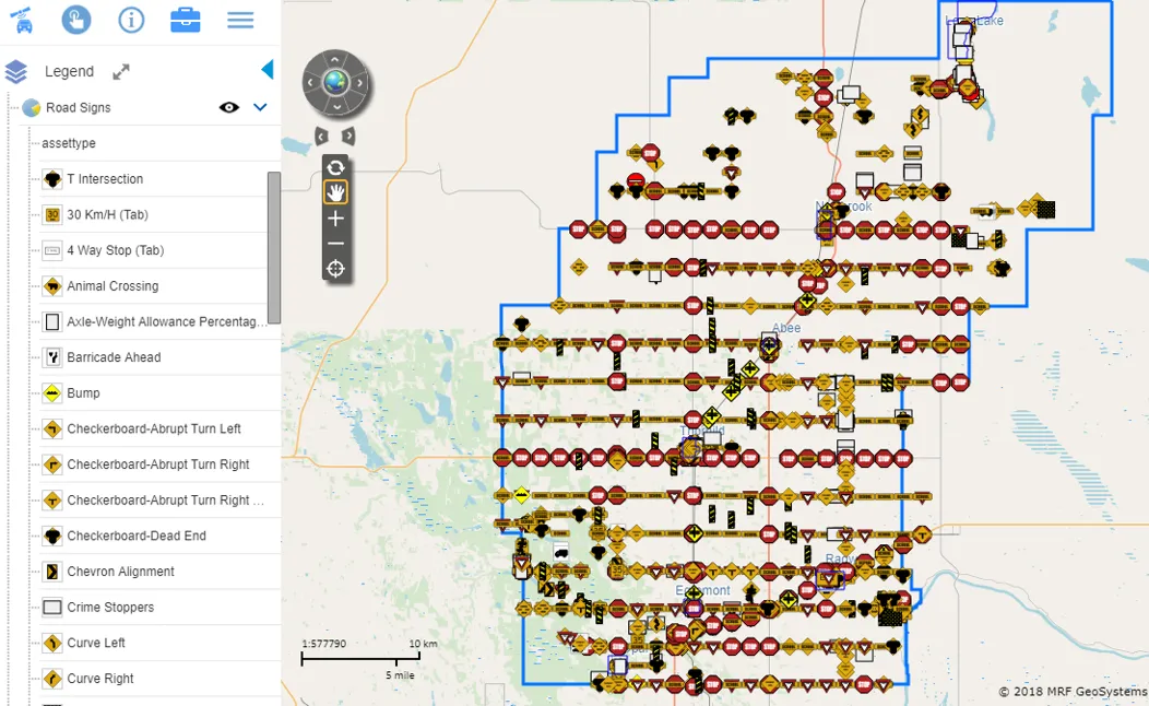
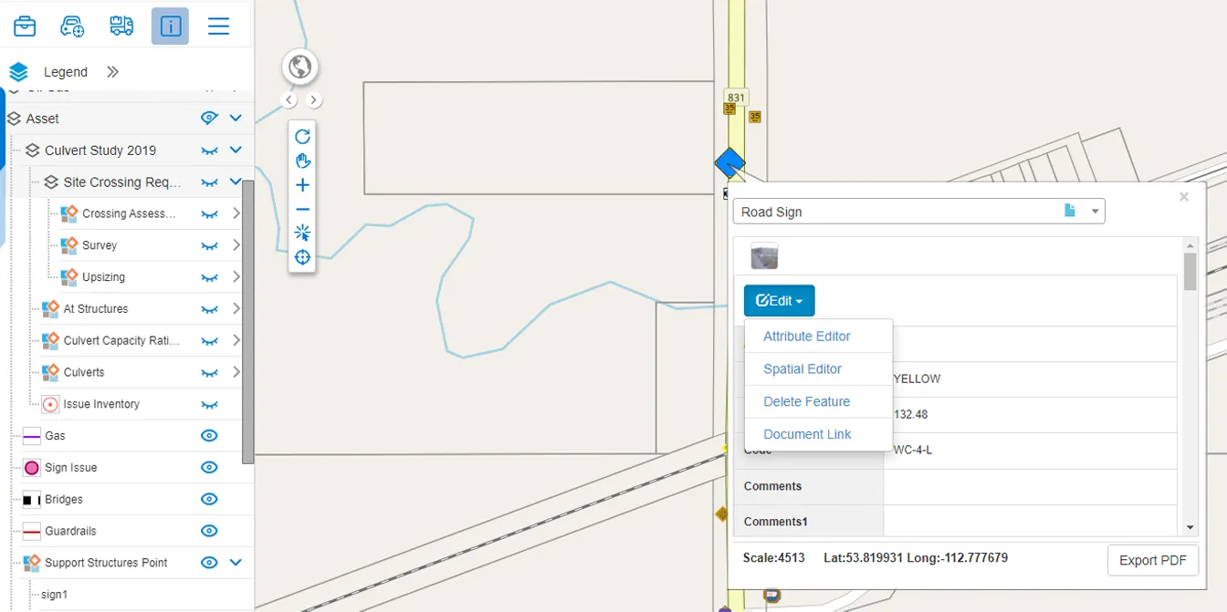
Manage roads, culverts, signs and other assets with the Asset Management module.
A municipal utility data model
MRF created a municipal utility data model to help municipal clients organize their utility and infrastructure data.
Elevation reports
Draw a line on the map to generate an elevation profile along it.
Road allowance records
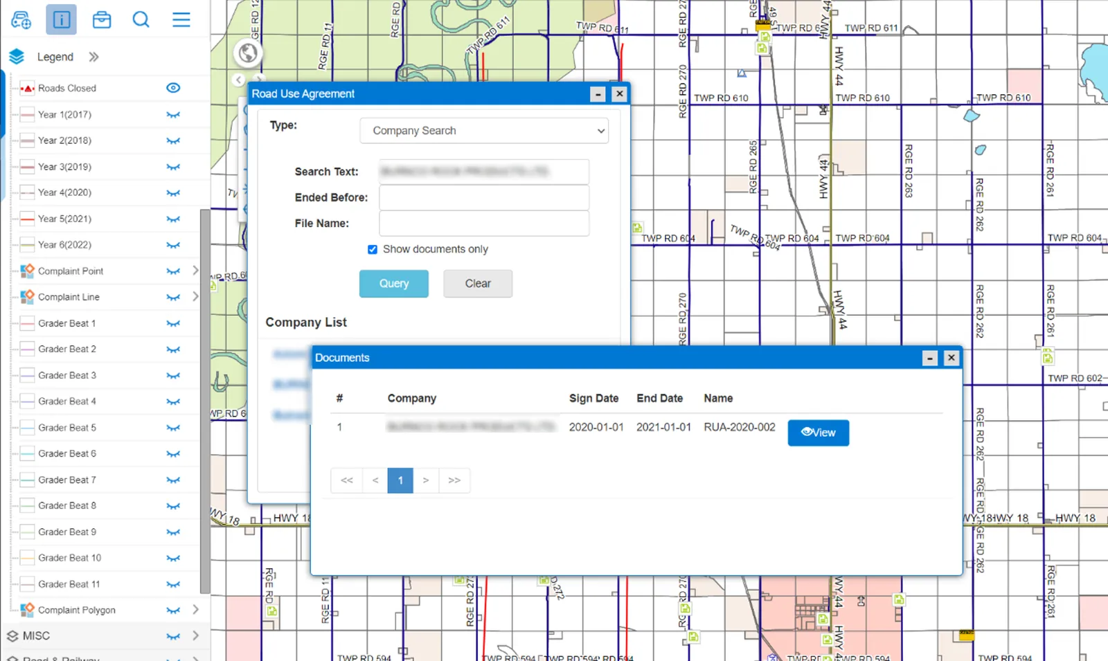
Manage road allowance and road use agreement records on the map.
A closer look

See it working with your own data.
Book a demo and we’ll walk you through the products that fit your departments, configured for organizations like yours.